Description
The C-MAP 4D North-West Africa M-AF-D210-MS is a full featured vector chart covering North-West Africa. This C-MAP 4D North-West Africa chart provides a wealth of chart detail, and you can customize data layers and how they are viewed. High Resolution Bathy Data and Sport Fishing Data are included, and more than 140 languages can be displayed.
Features
- Full featured vector charts with a wealth of chart detail and the versatility to customize data layers and how they are viewed.
- High Resolution Bathy Data is included, with the highest available detail of underwater pinnacles, ledges and canyons.
- Sport Fishing Data is included: angling intelligence for wrecks and reefs, Fish ID photos, fishing tips, updated regulations and state records.
- Tides and currents shown as interactive on-screen tide graphs and a current arrow.
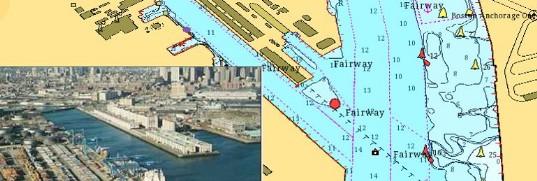
- Aerial photos of harbour entrances, channels and marinas.
- Guardian Alarms search for and alert you to rocks, obstructions, shallow depths and other navigation hazards.
- Multi-language charts display more than 140 languages using native character sets.
Specifications
| Model | M-AF-D210-MS |
| UPC | 9420024179840 |
| Manufacturer | C-MAP |
| Weight | 0.07 lbs |
| Dimensions | 4 × 6 in |