
Description
INTEGRATED MAPPING FOR A WIDE RANGE OF CHARTPLOTTERS
A comprehensive, all-in-one solution, Navionics+ charts and maps combine clear, reliable coastal/inland content with advanced guidance features and compatibility with a wide range of chartplotter brands — all backed by the world’s No. 1 name in marine mapping
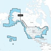
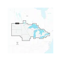
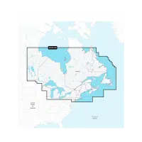
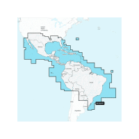
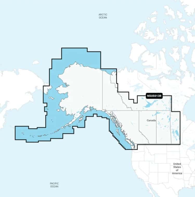
Navigate with the best offshore and inland lake coverage for your compatible chartplotter.
See it your way. Customize your view with various chart layers and overlay combinations.
With your included 1-year subscription, access daily updates via the Navionics chart installer software.
Advanced route guidance technology lets you navigate with suggested dock-to-dock routings.
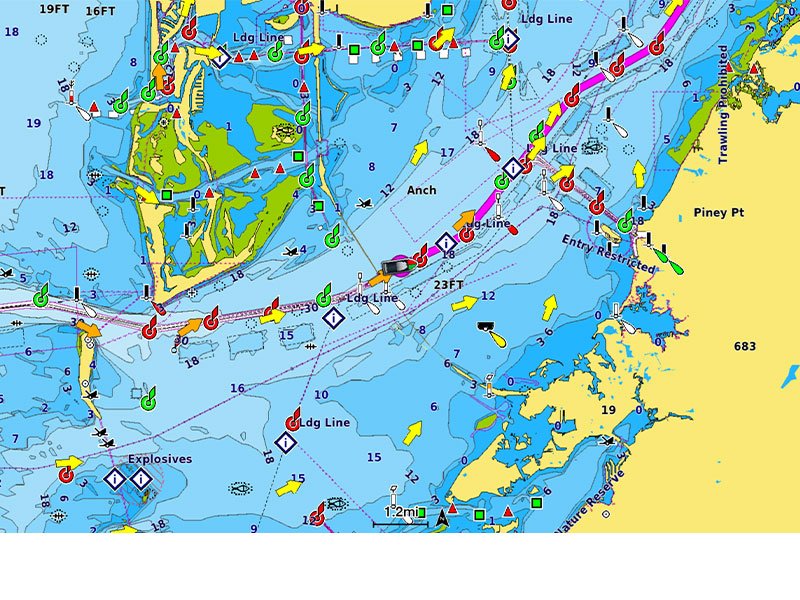
Selectable map options let you highlight shallow areas, adjust contour density or select a fishing range.
ALL-IN-ONE MAP SOLUTION-
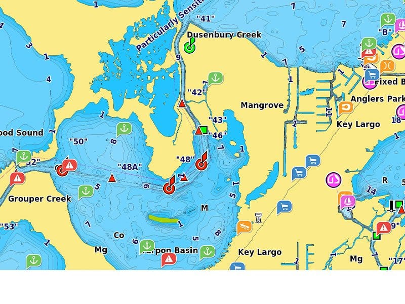
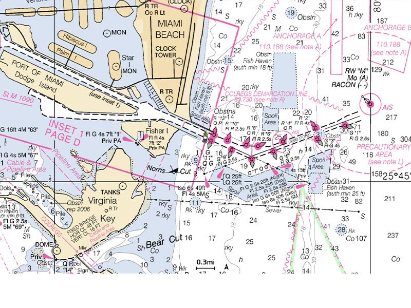
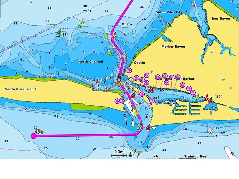
Access detail-rich mapping of coastal features, lakes, rivers and more on a wide range of compatible chartplotters. Integrated coastal and inland lake content offers coverage for boaters worldwide.
DAILY CHART UPDATES-
Charts are constantly being enhanced with new and amended content — thousands of updates are made every day. The included 1-year subscription gives you access to daily chart updates via the Navionics chart installer software.
DOCK-TO-DOCK ROUTE GUIDANCE-
Advanced route guidance technology uses your boat settings, along with chart data and frequently traveled routes, to calculate a suggested path to follow from dock to dock.
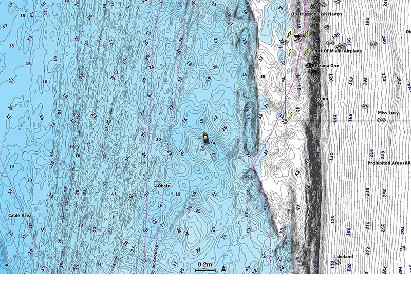
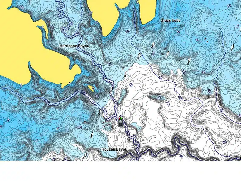
UP TO 1’ CONTOURS-
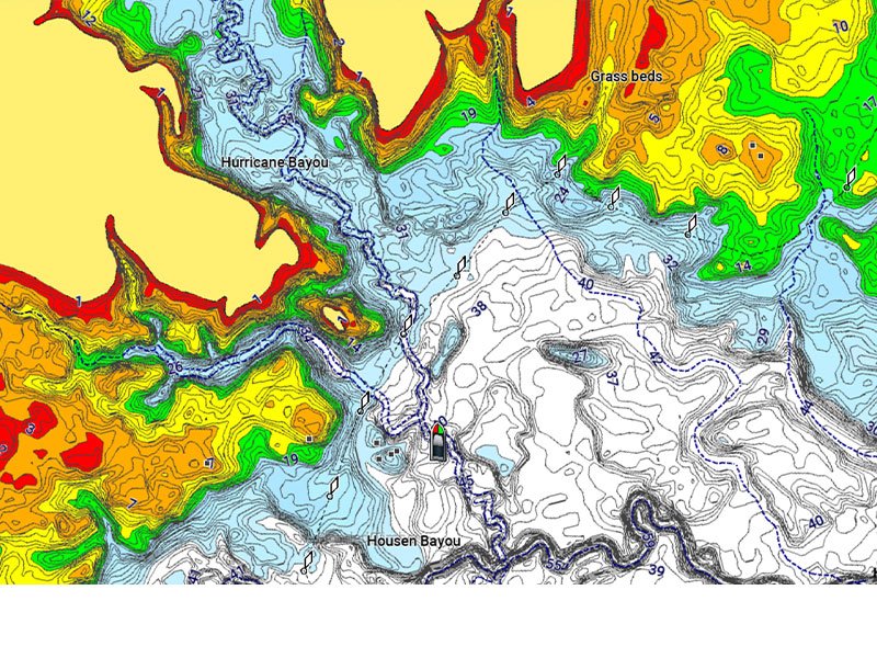
For improved fishing and navigation, up to 1′ contours provide a clear depiction of bottom structure for fishing charts as well as enhanced detail in swamps, canals, harbors, marinas and more.
ADVANCED MAP OPTIONS-
Change the way you view Navionics charts to focus on the details that matter most to you. Highlight shallow areas, adjust contour density, or select a fishing range.
COMMUNITY EDITS-
Download community edits for useful local knowledge added by users of the Navionics Boating app, and view the data on your compatible chartplotter.
PLOTTER SYNC-
Transfer routes and markers, update charts and more between your plotter card and mobile app — wirelessly. You can even activate or renew your cartography subscription and upload sonar logs.
SONARCHART LIVE MAPPING-
Create your own maps on the fly. Watch new 1’ HD bathymetry maps develop in real time as your boat moves through the water.
microSD/SD
Not compatible with Garmin Chartplotters