| Region |
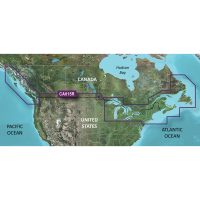
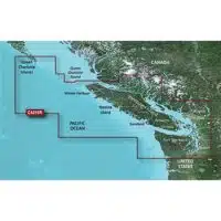
US001L U.S. & Coastal Canada, US005R U.S. North & Great Lakes, US006R U.S. South, US007R U.S. East, US008R U.S. West, US011R Canada North, US012R Canada, East & Great Lakes, US013R Canada, West & Alaska, SA004L Mexico, Caribbean to Brazil, SA005L Chile, Argentina & Easter Island, SA010R Central America & Caribbean, SA011R South America, North, SA012R Brazil, AE011L China Sea & Japan, AE016R Japan, AE018R Yellow Sea, AE019R Taiwan, AE020R South China & Andaman Seas, AE021R Philippines, AE025R Papua New Guinea & Solomon Island, AE093L Indian Ocean To Thailand, AE094L Indonesia and Malaysia, AF001R Africa, East, AF002R Africa, South, AF004R Africa, Northwest, AF005R Africa, West, AF630L Africa & Middle East, AW010R The Gulf & Red Sea, AW015R Indian Subcontinent, EU003R Great Britain, Northeast Coast, EU004R Irish Sea, EU006R Scotland, West Coast, EU008R Bay of Biscay, EU009R Portugal & Spain, Northwest, EU010R Spain, Mediterranean Coast, EU012R Mediterranean Sea, Central & West, EU014R Italy, Adriatic Sea, EU015R Aegean Sea, Sea of Marmara, EU016R Mediterranean Sea, Southeast, EU042R Oslo to Trelleborg, EU043R Iceland to Orkney, EU047R Gulf of Bothnia, EU050R Gulf of Finland & Riga, EU051R Norway, Lista to Sognefjord, EU052R Norway, Sognefjord to
Svesfjorden, EU053R Norway, Trondheim to Tromsø, EU054R Norway, Vestfjorden to Svalbard, EU055R Finland, Lakes & Rivers, EU060R Germany, Lakes & Rivers, EU063R Black Sea & Azov Sea, EU064R Greenland, EU066R Alpine, Lakes & Rivers, EU067R Sweden, Lakes & Rivers, EU069R Caspian Sea & Lower Volga River, EU071R Norway, Lakes & Rivers, EU072R U.K. & Ireland Lakes & Rivers, EU073R Italy, Lakes & Rivers, EU074R England, South Coast, EU075R Ireland, West Coast, EU076R Benelux & Germany, West, EU077R Denmark, Germany & Coastal Poland, EU078R Oslo, Skagerrak & Haugesund, EU079R Sweden, Southeast, EU080R France, Lakes & Rivers, EU081R Baltic Sea, East Coast, EU620L Greenland & Iceland, EU628L U.K., Ireland & Holland, EU643L Mediterranean & Black Sea, EU644L Baltic Sea, EU645L Scandinavia South & Germany North, EU646L Europe, Central & West, EU649L Norway, PC015L Australia, East & Central to New Zealand, PC016L Australia, West & Central, PC014L Pacific Islands, PC026R Australia, West, PC027R Australia, Northeast, PC028R Australia, Southeast, PC029R New Zealand, PC030R New Caledonia
|