

Description
Canadian Hydrographics Sailing Directions Central Canada
The “Canadian Hydrographics Sailing Directions: Central Canada” is an essential publication for mariners navigating the waterways of Central Canada. Produced by the Canadian Hydrographic Service, this guide provides comprehensive and authoritative information to promote safe and efficient travel through lakes, rivers, and coastal zones in the region.
The Sailing Directions include detailed descriptions of major navigation routes, harbor approaches, anchorages, and port facilities. Mariners will find guidance on local regulations, weather patterns, and navigational hazards such as shoals, currents, and restricted waters. The publication also offers valuable advice on seasonal considerations and the impact of ice and water level fluctuations, which are especially significant in Central Canadian waters.
In addition to navigational information, the guide covers points of interest, historical notes, and practical tips for communication and emergency procedures. It is designed to complement official nautical charts, providing context and clarity for charted features and updating mariners on important changes or developments affecting navigation.
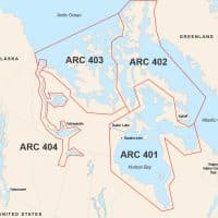
Whether transiting the Great Lakes, navigating the Winnipeg River, or approaching inland ports, mariners rely on the Canadian Hydrographics Sailing Directions for accurate and up-to-date information to ensure safe passage throughout Central Canada.