


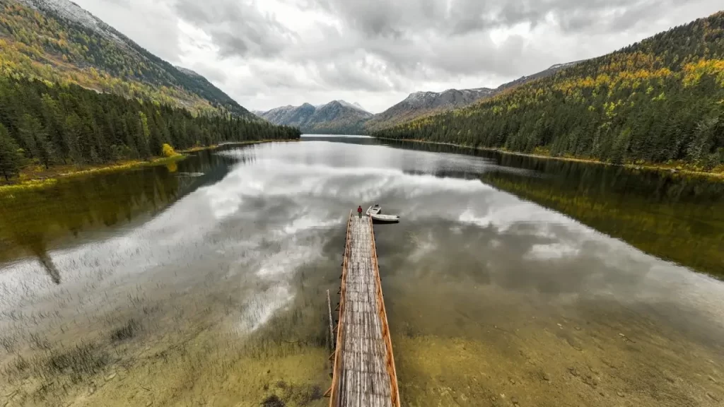
Before you tow to Pitt Lake, settle three things: where you will launch, what your boat and crew can handle, and which rules apply at your destination. Grant Narrows gives access at the lake’s southern end, while a river launch adds another leg to your journey. This guide to Pitt Lake covers the decisions behind a fishing day, a paddle to Widgeon Creek or an overnight stay at a marine campsite. Start with conditions, confirm access and fishing restrictions, then choose your route. A calm-looking ramp is only the beginning of the trip.
Pitt Lake Boating Conditions: Tides, Depth, Weather and Hazards
Pitt Lake Tides and Water Levels
Pitt Lake is a freshwater lake connected to the Fraser River by the lower Pitt River. This connection allows tides to influence the lake’s water level, so water beside a landing or shallow crossing will not necessarily stay at the same level.
When planning around Pitt Lake tides, account for river flow as well as water level. CHS(Canadian Hydrographic Service) sailing directions describe tidal reversals in the lower river and usually outward flow during freshet, the seasonal high-runoff period. Do not assume an incoming ocean tide will carry you upstream.
Use the City of Pitt Meadows’ Fenton gauge to understand river-level trends, then assess local depths separately. An assumed offset from a coastal tide table cannot establish clearance at a particular shoal.
Pitt Lake Weather and Wind Forecast
Check the Environment and Climate Change Canada hourly forecast for Pitt Meadows alongside warnings and information covering your intended route. Its city forecast is a starting point, not a measurement of conditions across the lake.
Strong, sudden outflow and inflow winds regularly develop along the lake’s axis in the afternoon, which matters most for paddlers and small-boat operators planning a return. Read any Pitt Lake wind forecast through your expected return time. Wind direction matters because your return heading might put you into waves that were behind you earlier. If the forecast or observed conditions exceed your boat’s capability or your crew’s experience, postpone the crossing. An early departure does not guarantee an easy afternoon.
Pitt Lake Depth
A 2019 federal COSEWIC status report lists Pitt Lake’s maximum depth as 143 metres (469 feet). That is the lake’s deepest point. The southern end near Grant Narrows has shallow areas, so boaters still need to check water depths along their planned route.
Canadian Hydrographic Service sailing directions describe extensive shallows and drying banks at the south end, with deeper water beyond Grant Channel. Base your route on local soundings and your boat’s draft, with clearance to spare.
Pitt Lake Map and Charts
Use a Pitt Lake map to locate destinations, then a nautical chart to plan your passage. Canadian Hydrographic Service Chart 3062, Pitt River and Pitt Lake, covers the waterway.
Obtain an up-to-date chart and its applicable corrections and keep an independent backup to your electronic display. Fishing-map pins and user markers do not establish current channel depth, public access or a suitable landing.
Hazards: Sandbars, Debris and Unreliable Cell Service
Stay within the charted approach through the southern shallows and keep watch for floating wood. Avoid shortcuts across water whose depth you cannot establish. In a March 2015 incident, Coquitlam Search and Rescue recovered two hypothermic canoeists stranded on a sandbar after a falling tide complicated their return.
BC Parks warns that cell service is poor or absent in many parts of Golden Ears Park. Before departure, check your carrier’s coverage information and ask boaters who have recently travelled your route about reception. Plan for a loss of signal even if others report service. Transport Canada recommends marine VHF for distress communications; confirm your equipment and emergency-contact plan suit the route, and consider a satellite device for remote stops. Save charts and trip information offline.
Guide to Pitt Lake: Choose a Route That Fits Your Boat
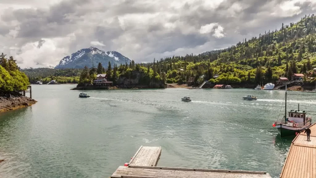
Choose the destination before deciding which equipment and access arrangements you need. Measure the outward and return passages on your chart, including any river travel; reaching the north end means planning for the lake’s length in both directions. Set a turnaround time that leaves a margin for deteriorating conditions.
| Trip | Access to Plan | Decision Before Departure |
| Widgeon Creek paddle | Grant Narrows and the channel through Widgeon Valley National Wildlife Area | Use a non-motorized boat on the authorized channel; assess the exposed crossing separately. |
| Lake fishing day | Confirmed lake launch, or a river launch followed by the passage upstream | Identify your fishing area and a return route your crew can manage. |
| Marine camping trip | Suitable lakeshore landing and overnight parking | Arrange the applicable permit and a backup destination before committing to the crossing. |
Environment and Climate Change Canada identifies non-motorized boating as an authorized activity in Widgeon Valley National Wildlife Area. Do not plan a motorboat trip through that channel to the campground.
Launching, Fishing and Camping at Pitt Lake: Step by Step
Pitt Lake Boat Launch Options and Fees
Choose between access near the lake’s southern outlet and a marina farther down the river. The extra river passage changes your navigation, fuel and return-time planning.
Grant Narrows Boat Launch
Grant Narrows boat launch is at the south end of the lake, reached via Rannie Road in Pitt Meadows. You will also see the area described as Grant Narrows Regional Park in older visitor information; the City of Pitt Meadows lists it as Pitt-Addington Marsh/Grant Narrows.
The City’s undated page directs launch inquiries to a provincial regional office and describes a dawn-to-dusk gate that is locked overnight. Before towing out, verify that the ramp is operating on your intended date and confirm gate hours and overnight vehicle or trailer arrangements with the site operator or the provincial contact listed by the City.
Pitt Meadows Marina Boat Launch
The Pitt Meadows Marina boat launch is on the Pitt River. Northland Asset Management’s marina listing identifies a launch among its facilities.
Before travelling, contact marina management to verify public launch access on your intended date, ramp suitability for your boat and trailer, payment methods and parking conditions. Include the connecting river passage in your route and fuel plan.
Pitt Lake Boat Launch Fee
Confirm the Pitt Lake boat launch fee and parking arrangements separately. Xwum’s undated rate page lists a launch charge plus distinct day and overnight parking charges.
The page also displays a seasonal closure banner. Before travelling, ask Xwum whether that notice applies to rentals, ramp access or both, and verify the current charges and accepted payment methods.
How to Launch a Boat at Pitt Lake
Before using an unfamiliar ramp, confirm its current condition and any boat or trailer limits with the operator, and ask recent users about changes. The following steps are a general checklist; follow the instructions for your boat, engine and trailer. Complete your preparations away from the ramp so you can launch without blocking others.
- Load and secure your equipment in the staging area. Fit the drain plug before launching, and have your dock lines and fenders ready before moving to the ramp.
- Inspect the ramp before reversing. Assess the surface, water depth and trailer path, following your tow vehicle and trailer instructions.
- Back down slowly. Keep the boat secured to its trailer until it is supported by the water and your crew is ready to control it.
- Follow the engine manufacturer’s starting procedure and confirm normal operation before departing. Move to an authorized waiting area while the driver parks.
- Leave the approach slowly and follow the marked channel. Transport Canada’s April 2026 restriction schedules list a maximum of 10 km/h (6.2 mph) over the ground at Grant Narrows; reduce speed further when conditions require it.
After recovery, move to a safe area on dry land, drain the watercraft and remove the drain plug before road transport. B.C.’s plug-removal requirement took effect on May 17, 2024. Use a boat launch checklist to keep both ends of the day orderly.
Pitt Lake and Pitt River Fishing

Start your fishing plan with the waterbody and target species. The lake, river reaches, and tributaries have separate entries and boundaries in the regulations.
Pitt Lake Fishing
BC Parks identifies cutthroat trout as a fishing attraction here. Choose a tackle for your intended method and identify your catch before deciding whether it can be retained.
North of the fishing-boundary signs on the east and west shores near the lake’s head, the 2025-2027 provincial synopsis requires releasing wild trout and char and using a single barbless hook. Locate those signs before choosing your fishing area.
Lower Pitt River Fishing
Lower Pitt River fishing requires attention to the CPR Bridge boundary. DFO identifies the water downstream as tidal for fishing purposes and the water upstream as non-tidal, with different licences and regulations applying on each side.
The 2025-2027 synopsis prohibits fishing from one hour after sunset until one hour before sunrise on the reach from the CPR Bridge upstream to Pitt Lake; tributaries are excluded from that particular restriction. Set your final cast and ramp return as separate deadlines.
Physical tidal movement does not determine the fishing-licence boundary.
Upper Pitt River Fishing
Treat upper Pitt River fishing as a separate river outing. Reaching the north end of the lake does not establish that your boat is suitable for the passage farther upstream.
The 2025-2027 provincial synopsis bans bait in the Pitt River upstream of Pitt Lake and lists a fishing closure for the Pitt River within Garibaldi Park. Confirm the reach you intend to visit with your guide or accommodation provider, and arrange suitable river transport before committing to the lake crossing.
Pitt Lake Fishing Regulations
Use B.C.’s 2025-2027 Freshwater Fishing Regulations Synopsis, its Region 2 exceptions and in-season amendments together. The Province’s freshwater fishing regulations page provides those references.
DFO manages salmon rules, including in freshwater. Its Region 2 salmon regulations allow salmon fishing in waters flowing into Areas 28 and 29 only where an opportunity is listed. A no-fishing restriction applies even when you intend to release the catch.
Before fishing, you must verify the current rules for your exact waterbody, date and species. If the provincial or DFO notices are unavailable or unclear, contact the relevant fisheries office first. Use the confirmed rules when selecting your fishing tackle.
Pitt Lake Fishing Report
A useful Pitt Lake fishing report identifies when and where someone fished, the species and the conditions. Check whether a report concerns the lake, lower river or upper river before using it to plan your day.
Ask local guides or boaters who have recently fished your intended reach about conditions and access, and confirm when their observations were made. Their reports can help with planning; verify fishing permission and retention rules through the official sources above.
Pitt Lake Camping and Lodging
For Pitt Lake camping, distinguish the Widgeon paddle route, lakeshore marine sites and private lodging. Before departure, verify current access, closures and permit instructions with BC Parks. Ask recent visitors about landing conditions, as a campground listing does not establish whether the landing suits your boat on the day.
Widgeon Creek Campground
Widgeon Creek Campground is in Pinecone Burke Park and is reached by paddling through Widgeon Slough. BC Parks restricts camping to designated tent pads and prohibits camping along the riverbanks beyond the campground to protect salmon habitat. BC Parks lists these sites as first come, first served, with no reservation or backcountry permit registration required.
Use the provided food cache and pack out all waste. Pinecone Burke has a permanent campfire ban, so plan stove cooking subject to applicable restrictions. Bring drinking water or treat collected water before use.
Pitt Lake Marine Campsites
Named Pitt Lake marine campsites include Dark Creek on the western shore in Pinecone Burke Park, plus Osprey Creek North, Osprey Creek South and Raven Creek on the eastern shore in Golden Ears Park. Dark Creek follows Pinecone Burke’s first-come system without backcountry permit registration.
BC Parks requires backcountry permit registration for those three Golden Ears sites. Its permit registration guidance distinguishes a permit from a reservation: registration does not guarantee a tent pad. Have a workable alternative if your intended landing or campsite is unavailable.
Pitt River Lodge
Pitt River Lodge is a private accommodation option in the upper valley. Its FAQ describes available boat or air access, with crew-boat pickups from Grant Narrows.
Before booking or travelling, verify operating dates, pickup arrangements and parking instructions directly with Pitt River Lodge. If you plan to arrive in your own boat, ask the lodge to confirm permission and arrangements for using its dock.
Safety Equipment and Recommended Supplies for Your Pitt Lake Adventure
Match equipment to your boat’s type and length. Transport Canada requires a correctly sized, Canadian-approved lifejacket or PFD for every person aboard, including people in human-powered craft. Wear yours while afloat; cold water makes putting one on after a fall difficult.
Verify the legal equipment checklist for your craft’s type and length in Transport Canada’s current Safe Boating Guide. Use the following packing suggestions alongside that checklist:
- Choose lifejackets and PFDs that fit each person and suit the activity.
- Carry marine communication equipment appropriate to the route, with charged power supplies.
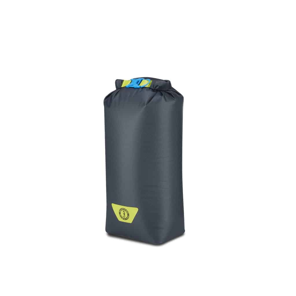
- Keep spare clothing and your emergency kit in a waterproof storage so a wet landing does not soak everything.
- Match anchoring equipment to your boat, intended bottom and stopping depth.
- Inspect fuel tanks and fuel lines and carry sufficient fuel for the full route with a reserve.
For overnight trips, add the camping equipment and waste storage your destination requires. Leave your route, expected return and overdue-response instructions with a responsible person ashore, then close the trip plan when you return.
FAQs
Is Pitt Lake affected by tides?
Yes, a shoreline landing that worked on arrival could leave your boat aground later, so allow for changing water levels when stopping.
How Deep Is Pitt Lake?
The federal report cited above gives a maximum of 143 metres (469 feet). That figure is unsuitable for selecting an anchoring location; use the charted depth at your intended stop.
Where Can You Launch a Boat on Pitt Lake?
Grant Narrows provides access at the south end. If you choose Pitt Meadows Marina, include the connecting river passage in your route and fuel calculations.
What Is the Pitt Lake Boat Launch Fee?
Get the current launch and parking charges from the facility you intend to use. For a camping trip, ask specifically about overnight vehicle and trailer arrangements.
Where Can You Check the Pitt Lake Weather and Wind Forecast?
Start with ECCC’s local forecast and warnings, then assess conditions for the entire route. Recheck the forecast’s issue time before leaving reception, particularly before an overnight trip.
What Are the Fishing Regulations for Pitt Lake?
Combine provincial freshwater rules and water-specific exceptions with DFO’s salmon rules. If you move across a fishing boundary, reassess the applicable licence and restrictions before casting.
Can You Camp on Pitt Lake?
Yes, designated water-access campgrounds provide options. Choose the campground first, then establish its access, permit requirements and landing arrangements.