
Description
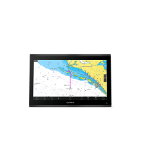
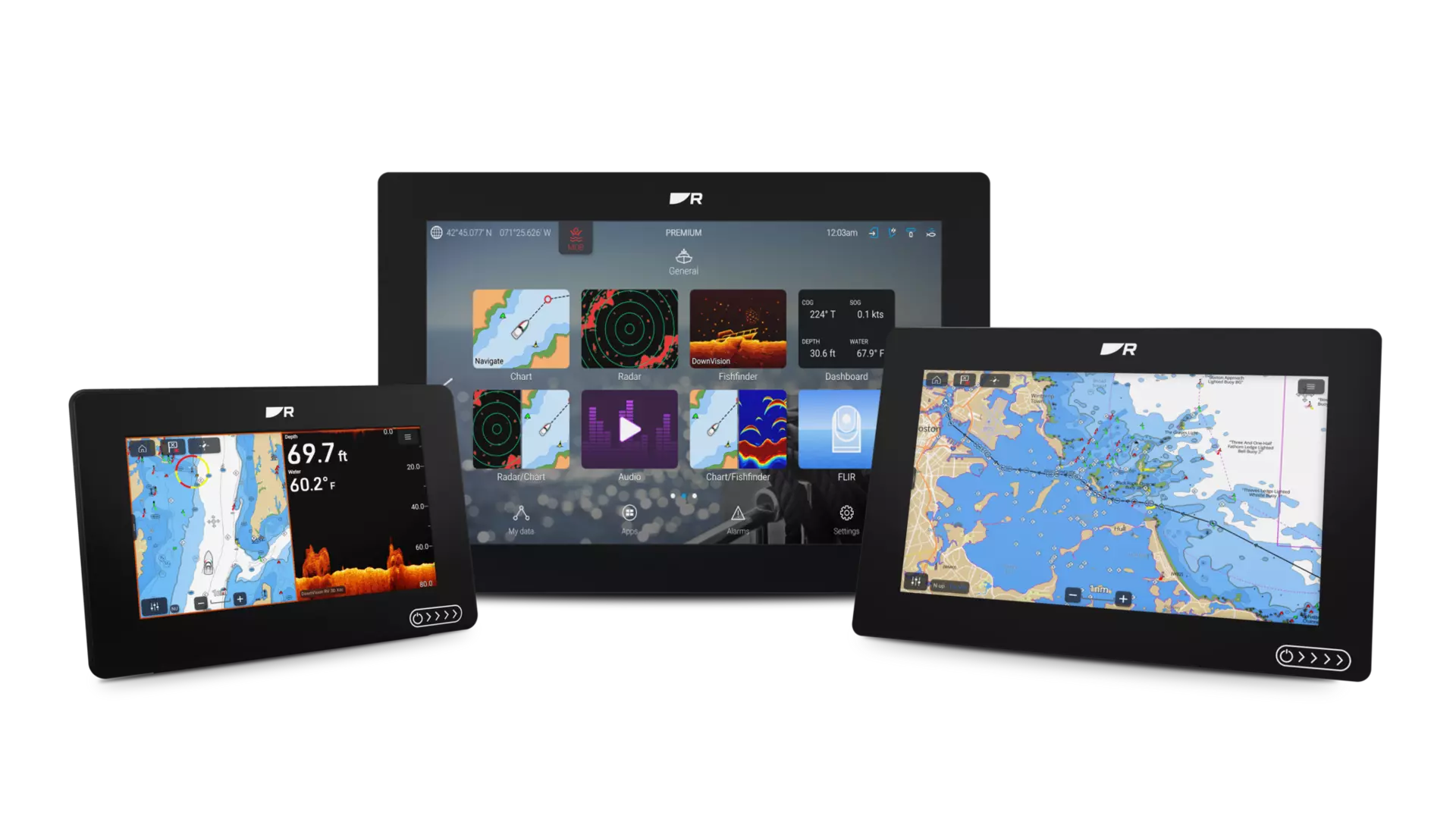
Axiom 2
Axiom 2 chartplotters deliver faster performance and upgraded processing power in 7-, 9-, or 12‑inch sizes. Available as chartplotter‑only or with built‑in RealVision™ sonar.

The Marine Chartplotter You Trust. Now Even Better
Our most popular marine chartplotters — now faster, more connected and built for the future. Axiom 2 unifies navigation, sonar, radar, video and NMEA 2000 networks into one powerful display. Choose Axiom 2 as a dedicated chartplotter for confident navigation, or step up to Axiom 2 RV for the ultimate all‑in‑one chartplotter and fish finder combo.
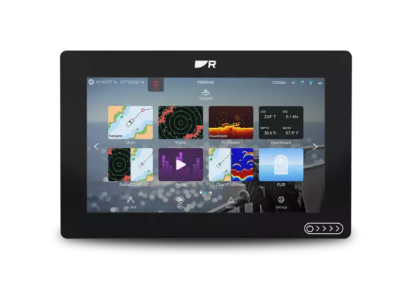
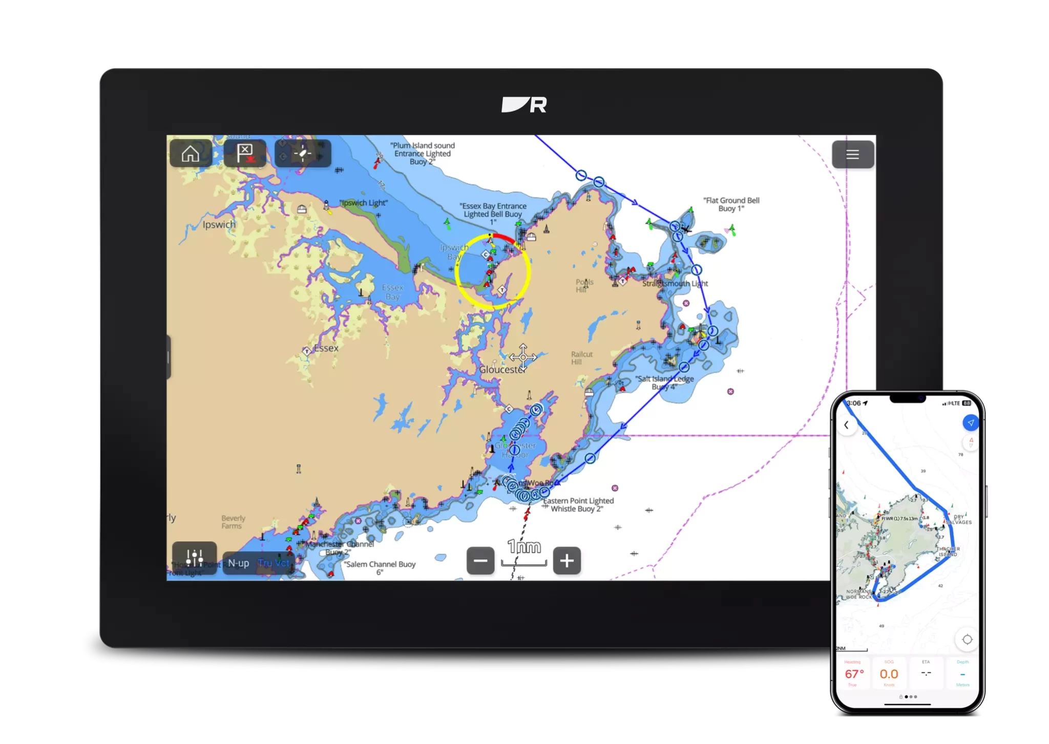
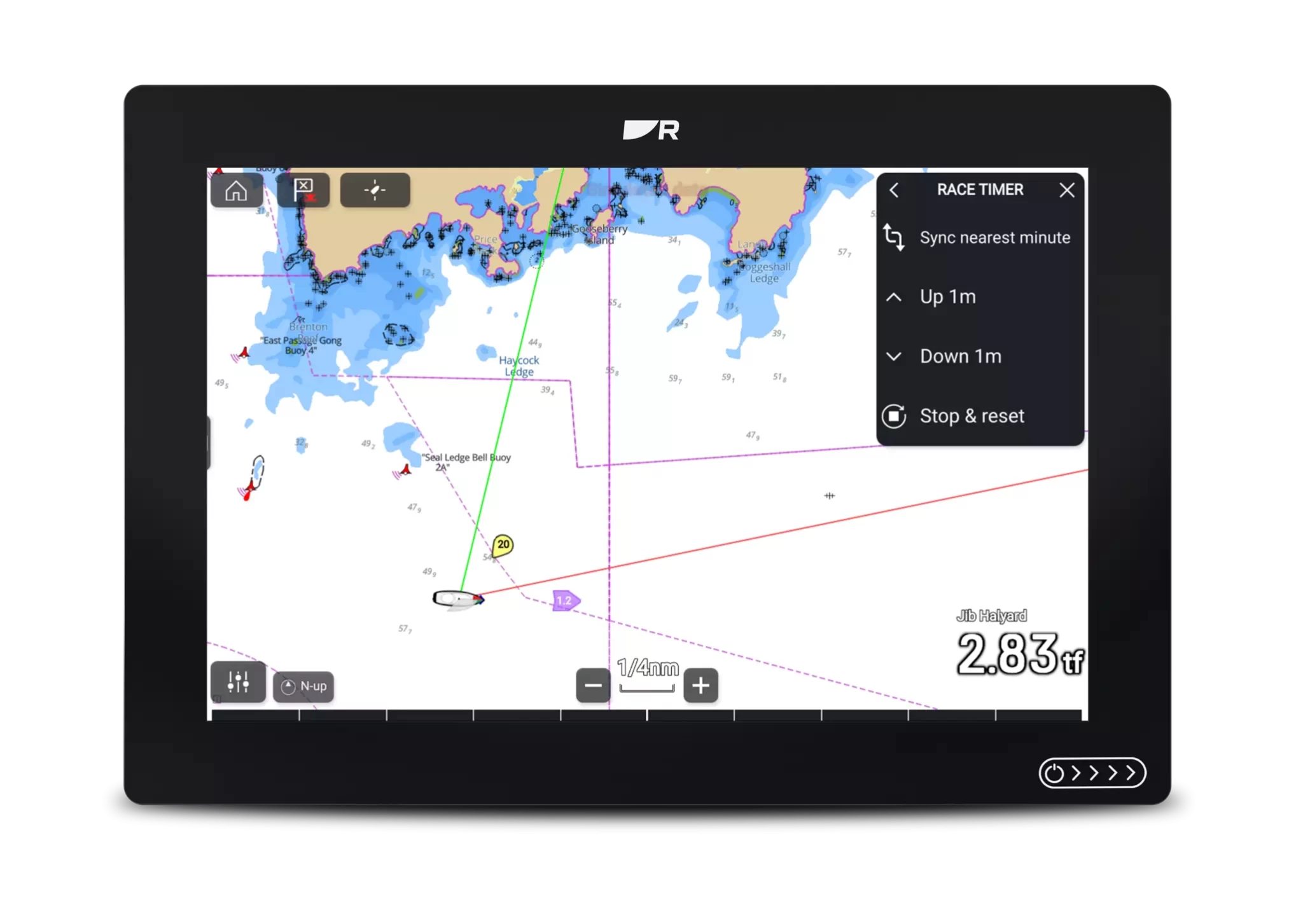
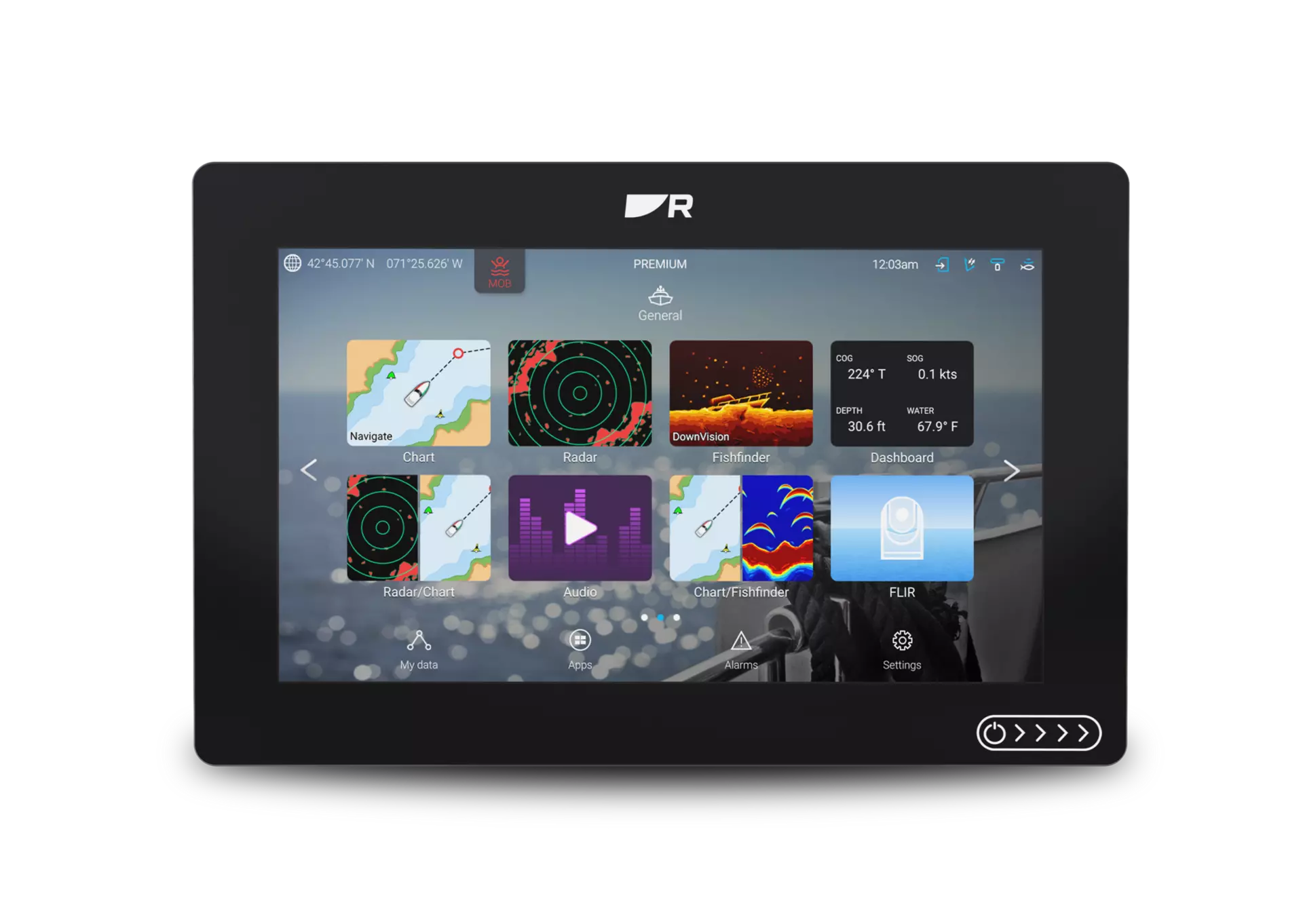
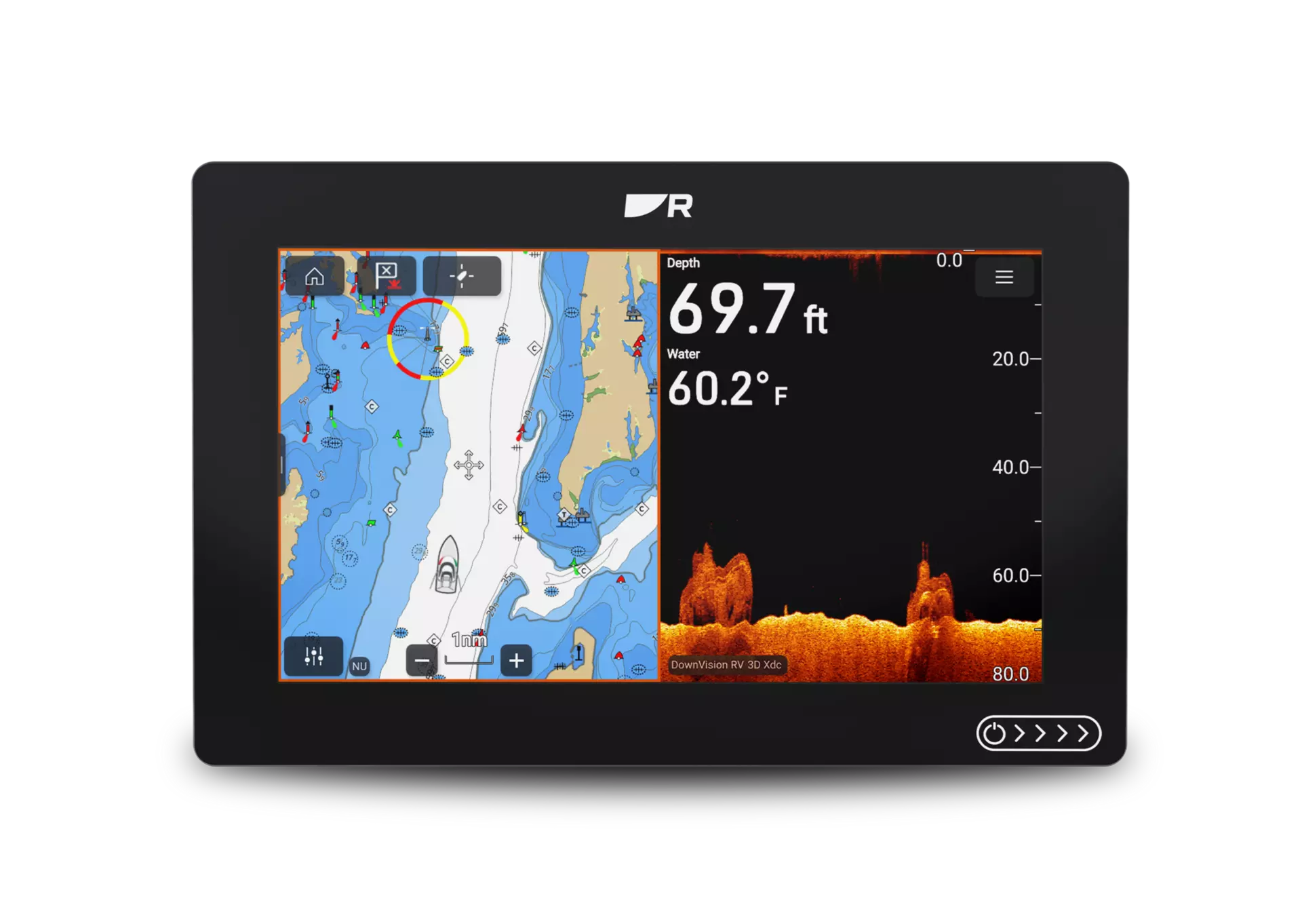
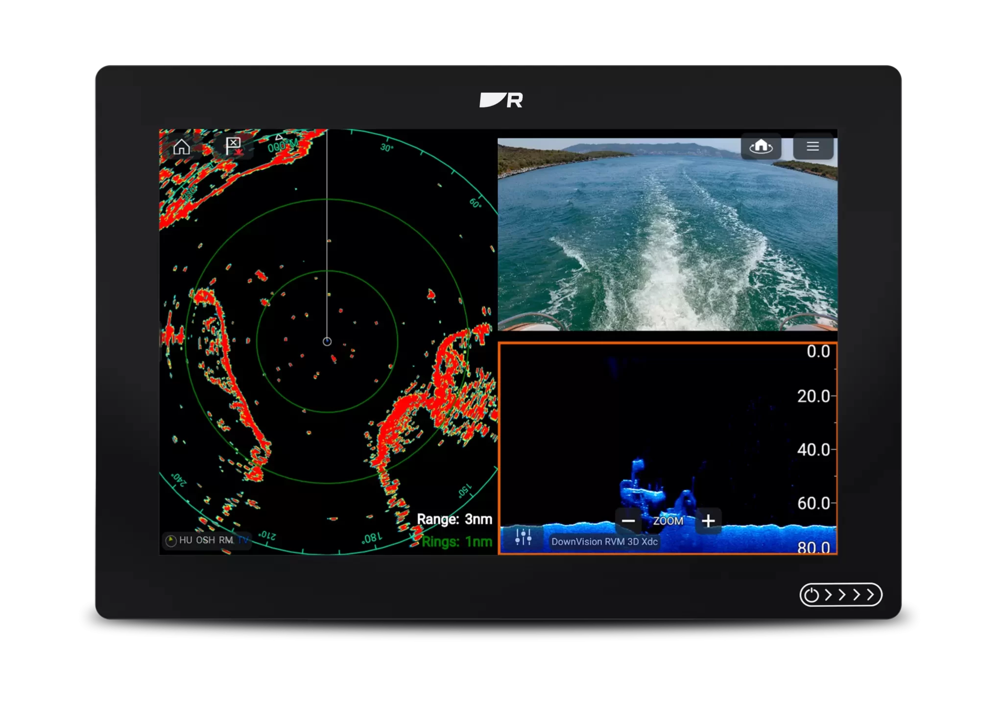
One Display. Total Control
Axiom 2’s LightHouse operating system is a single, simple-to-use interface for complete situational awareness. Make Axiom 2 your all-in-one multifunction display or connect additional Axiom 2 displays at your helm or a remote station.
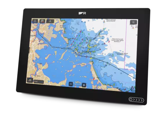
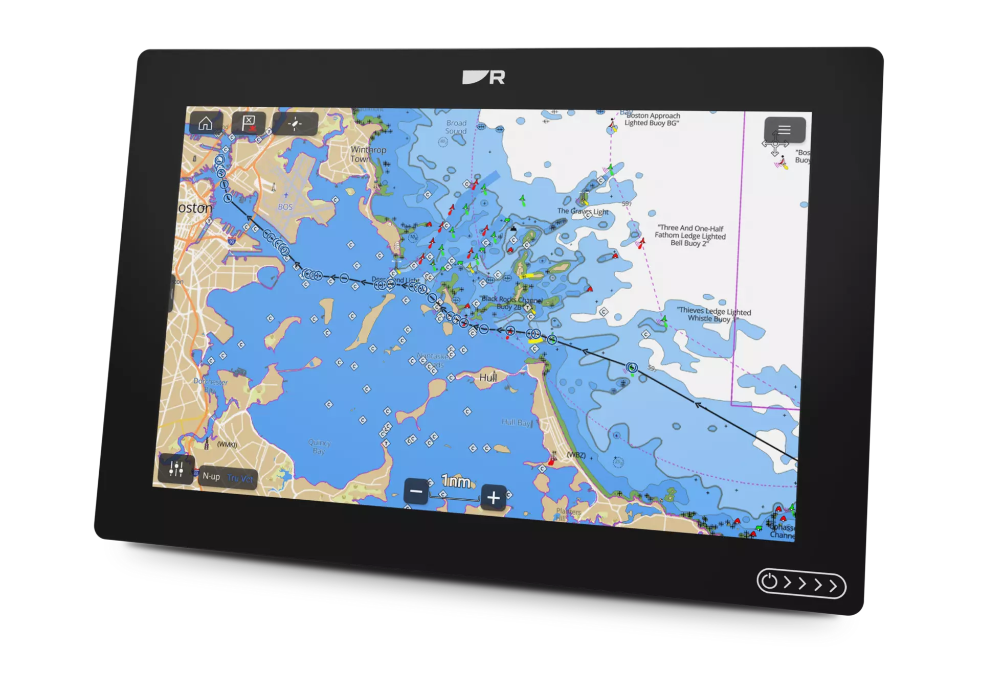
Navigate Smarter with LightHouse Charts GEN 2
Up to 30% faster chart rendering with a new 6‑core processor and LightHouse OS. Choose Axiom 2 bundled with LightHouse Charts GEN 2 for smoother panning, faster redraws and expanded coverage.
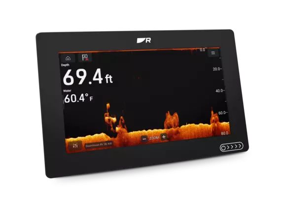
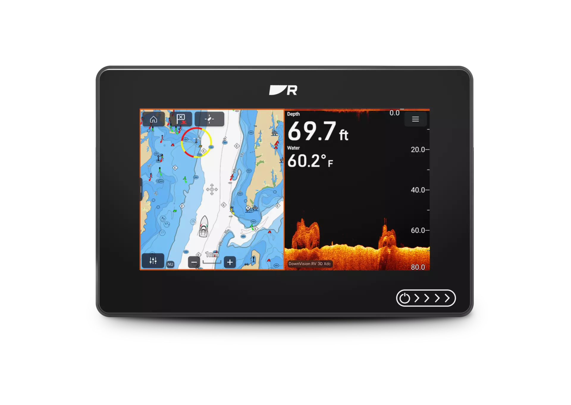
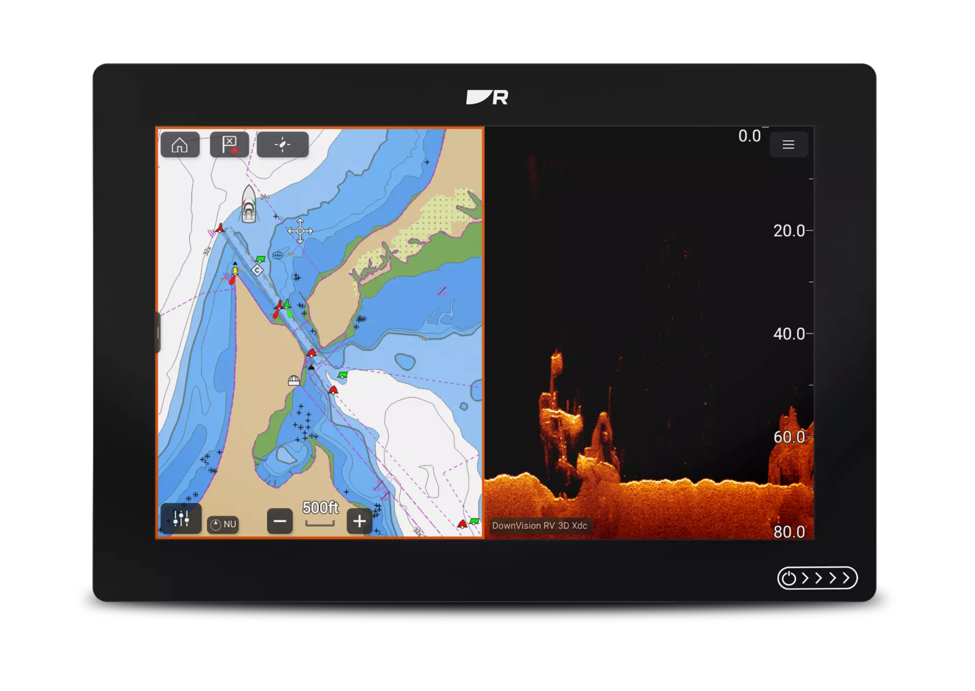
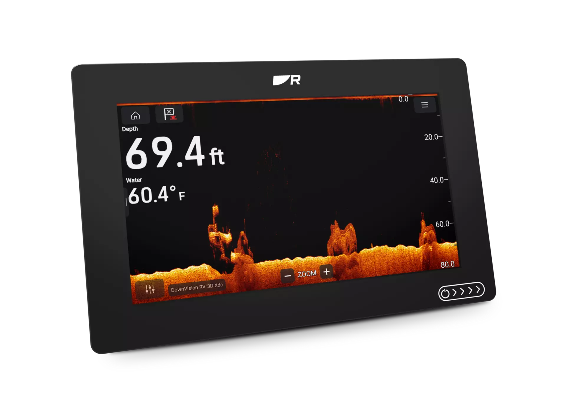
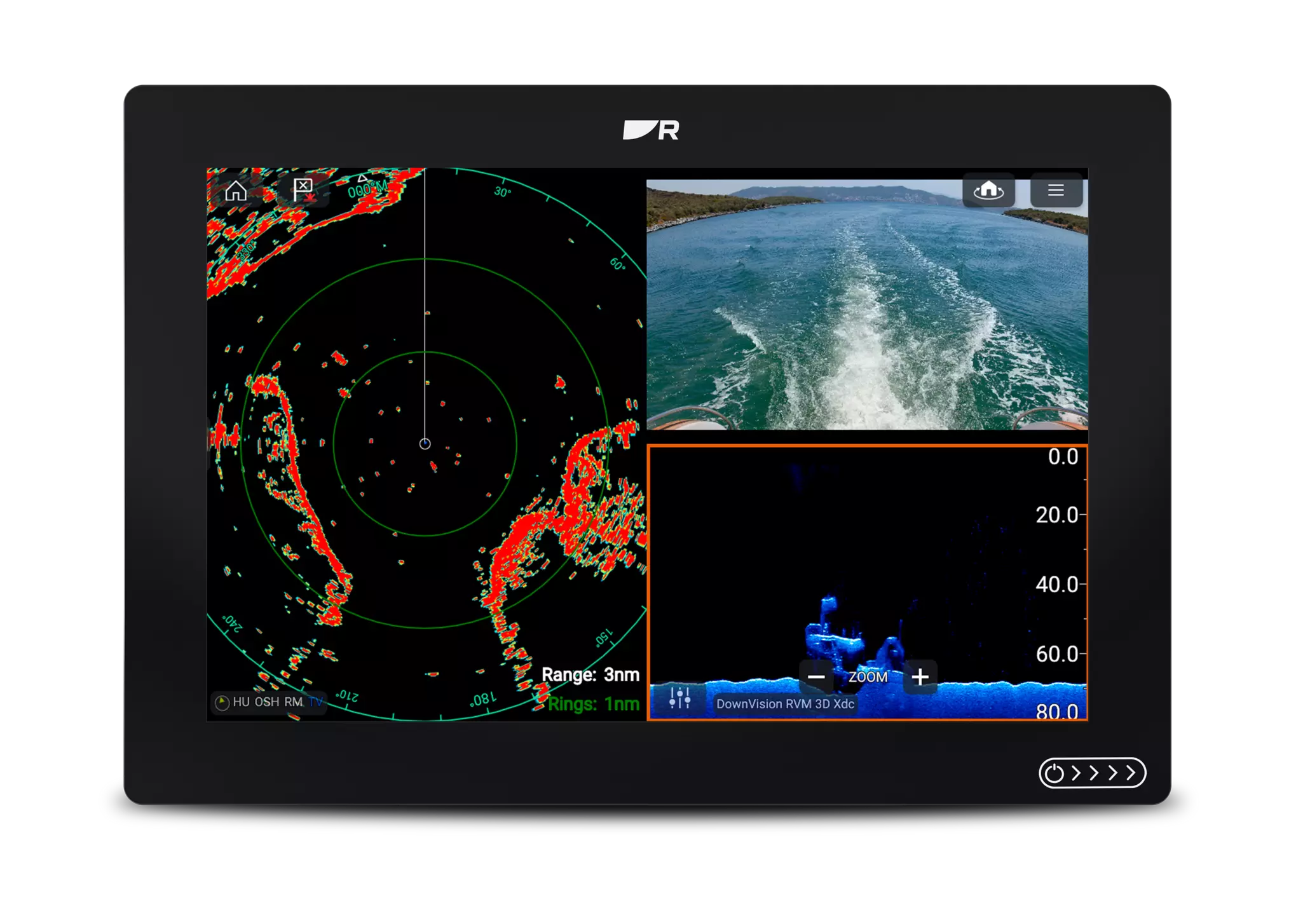
See More Below the Surface with RealVision Fish Finder
Scan wider, see deeper and understand the bottom instantly with SideVision™, DownVision™, RealVision™ 3D, and 600W CHIRP sonar – all built in. With an all‑in‑one GPS chartplotter with fish finder, you can spot fish faster, view underwater structure clearly, and fish confidently from every angle.
Built for Speed and Expansion
Gigabit RayNet Ethernet enables faster networking between displays and sensors. Experience smoother radar, sonar and video performance across the system.
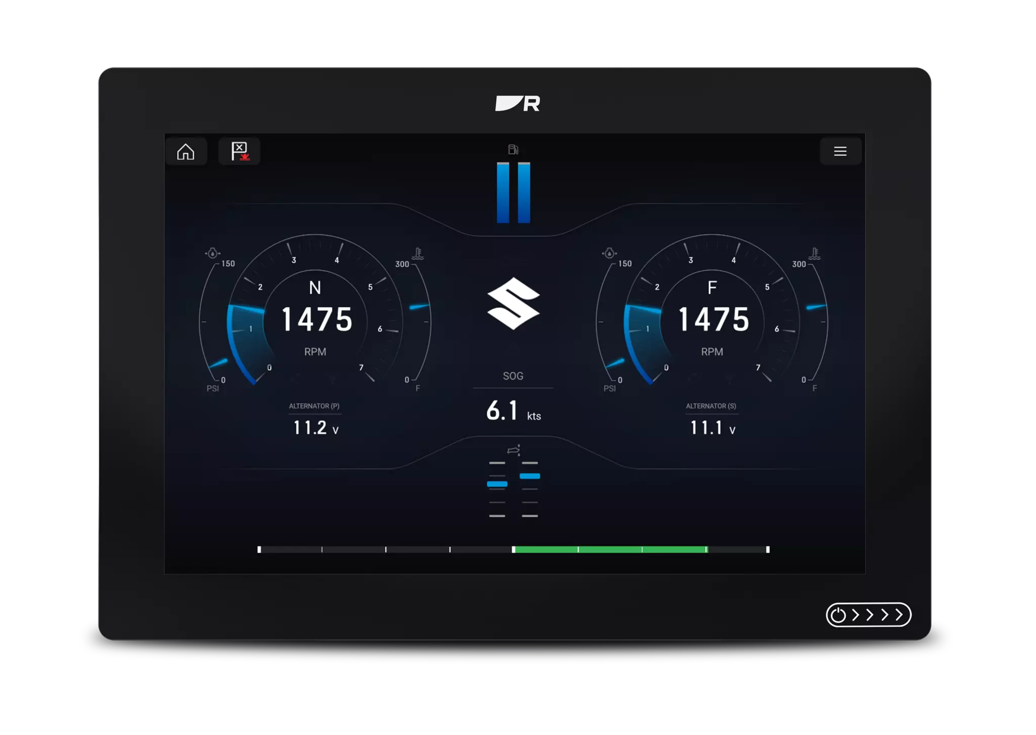
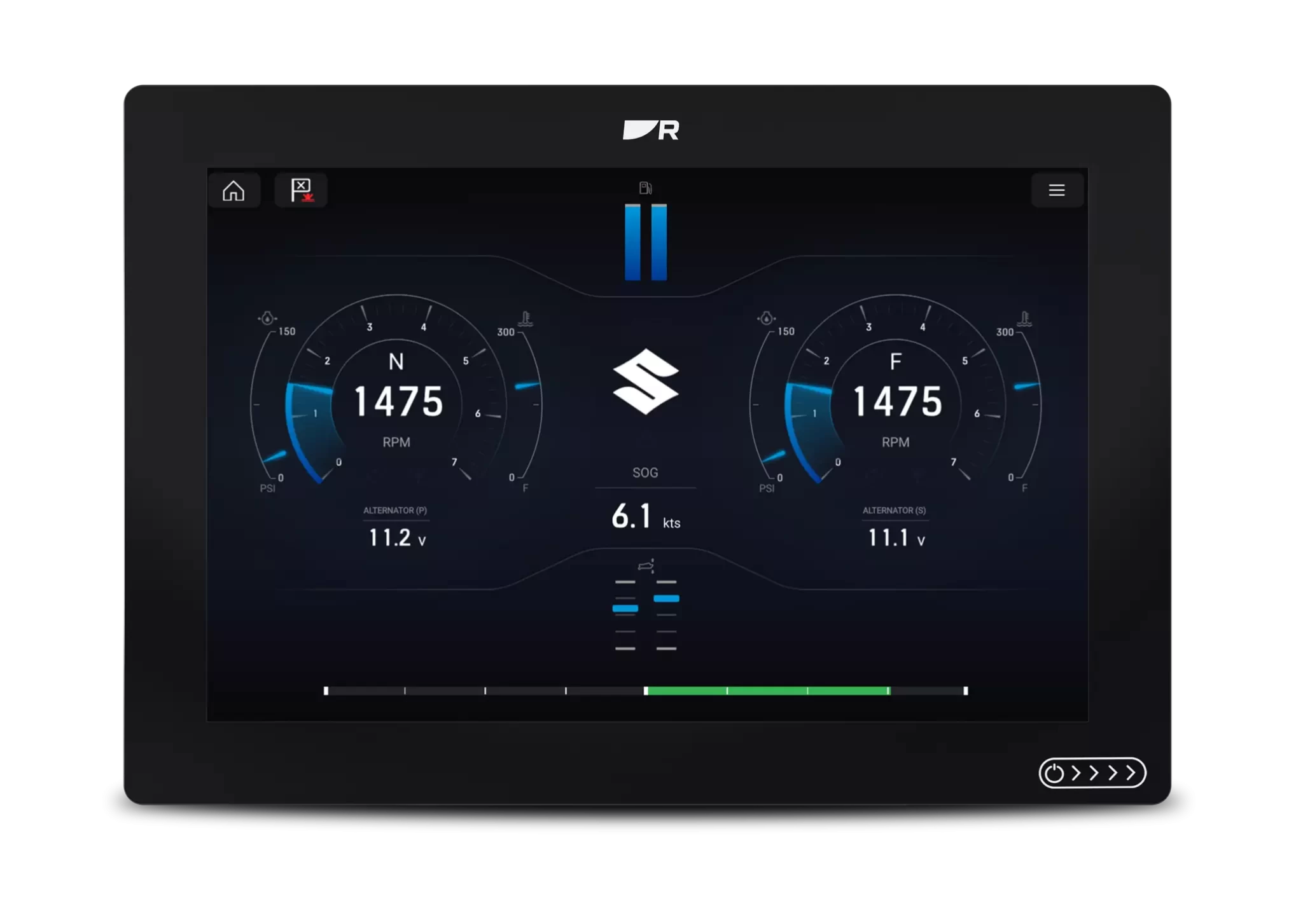
Engine Monitoring
Connect with leading engines including Mercury, Yamaha Suzuki and more. Monitor performance, fuel, and propulsion data directly from the helm.
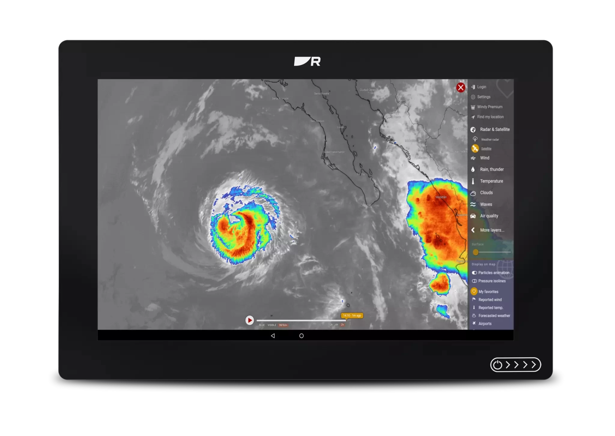
More capability, built in
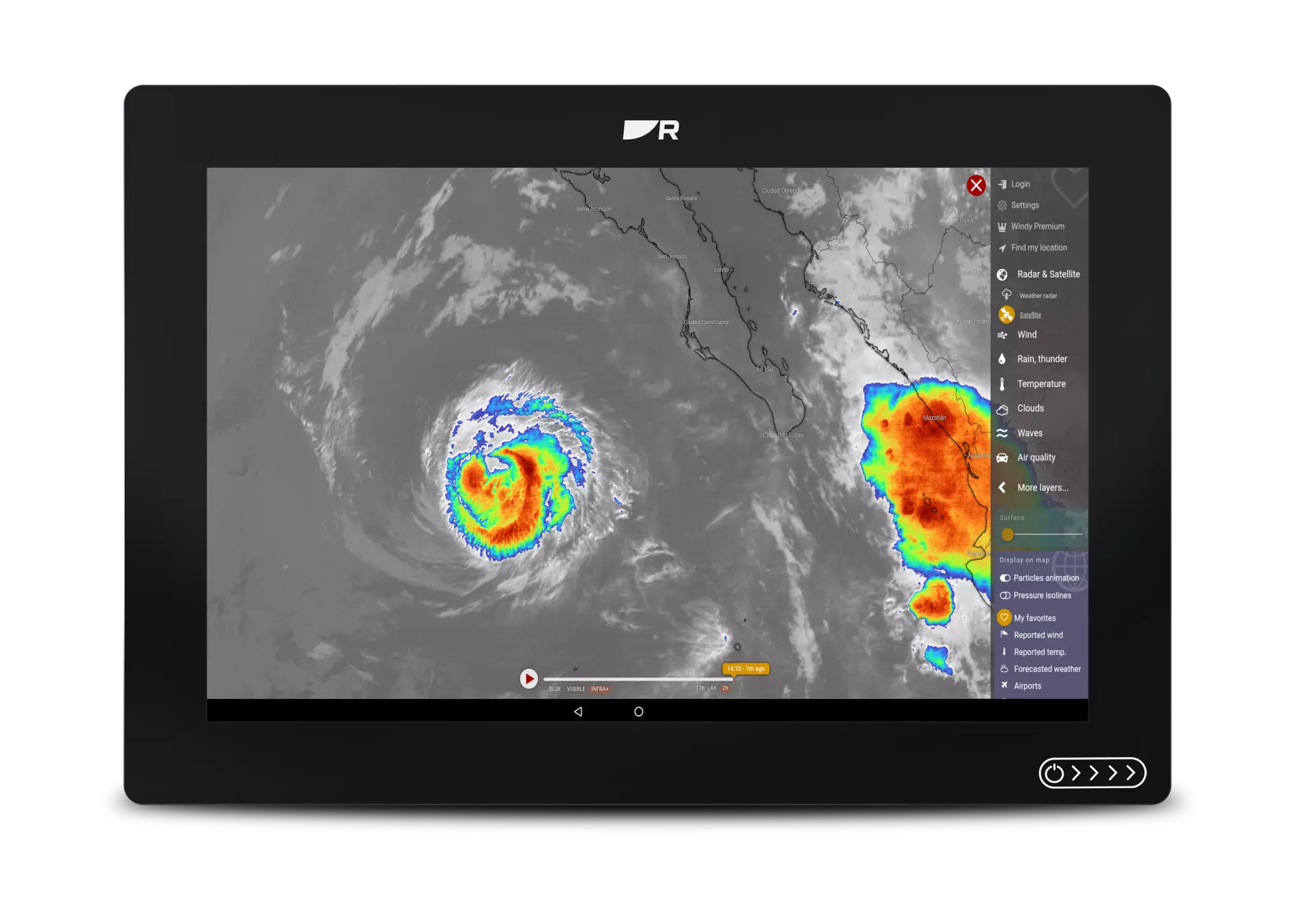
Expand your Axiom 2 with access to 30+ marine apps. Take control of lighting, audio, energy monitoring and weather systems. Or stream entertainment from Netflix, YouTube and Spotify.
Specifications:
| Physical | |
|---|---|
|
Dimensions (Trunnion mounted) |
Axiom 2 7″ Width: 250.4 mm (9.86 in), Height: 162.5 mm (6.4 in), Depth including cables: 218 mm (8.58 in) Axiom 2 9″ Width: 265.03 mm (10.43 in), Height: 187.81 mm (7.39 in), Depth including cables: 178 mm (7.01 in) Axiom 2 12″ Width: 314 mm (12.36 in), Height: 217 mm (8.54 in), Depth including cables: 178 mm (7.01 in) |
|
Dimensions (Surface/Flush mounted) |
Axiom 2 7″ Width: 201.1 mm (7.92 in), Height: 133 mm (5.24 in), Depth including cables: 218 mm (8.58 in) Axiom 2 9″ Width: 244.08 mm (9.64 in), Height: 157.78 mm (6.21 in), Depth including cables: 178 mm (7.01 in) Axiom 2 12″ Width: 314 mm (12.36 in), Height: 226.72 mm (8.93 in), Depth including cables: 178 mm (7.01 in) |
|
Accessory connection |
USB Micro B |
|
Ethernet connection |
RayNet (10 / 100 / 1000 Mbit/sec Ethernet) |
|
External storage |
MicroSDXC card slot x 1 |
|
NMEA 2000 connection |
DeviceNet (male connector built into power cable) |
|
Wireless connections |
Bluetooth: V4.0, Wi-Fi: 802.11/b/g/n |
|
Internal storage |
64 GB |
|
Transducer connection |
25 pin RealVision type connector. Requires the A80490 adaptor cable for CPT-S style transducers |
| Power | |
|---|---|
|
Power consumption |
Axiom+ 7: 9.84 W Axiom+ 9: 11.98 W Axiom+ 12: 18.96 W |
|
Operating voltage range |
8 V dc to 16 V dc |
|
Fuse rating |
7 A |
|
Nominal supply voltage |
12 V dc |
|
LEN (NMEA 2000 Load Equivalency Number) |
1 |
| LCD | |
|---|---|
|
Resolution |
Axiom 2 7: WSVGA 1024 x 600 Axiom 2 9: Widescreen HD 1280 x 720 Axiom 2 12: WXGA 1280 x 800 |
|
Display Brightness |
Axiom 2 7: 1800 nits / 1800 cd/m2 Axiom 2 9: 1500 nits / 1500 cd/m2 Axiom 2 12: 1800 nits / 1800 cd/m2 |
|
Protective coating |
HydroToughTM Oleophobic |
|
LCD Type |
IPS (In-Plane Switching) |
| GPS | |
|---|---|
|
Position Accuracy |
Without SBAS: ≤ 15 metres 95% of the time, With SBAS: ≤ 5 metres 95% of the time |
|
Geodetic Datum |
WGS-84 (alternatives can be selected on the MFD) |
|
Satellite Differential Type (SBAS) |
WAAS (United States), EGNOS (Europe), MSAS (Japan), GAGAN (India), QZSS (Japan) |
|
Channels |
Track up to 28 satellites simultaneously |
|
Antenna |
Internal – Ceramic chip mounted near top of unit |
|
GNSS compatibility |
GPS, GLONASS, Beidou |
|
Almanac Update |
Automatic |
|
Signal Acquisition |
Automatic |
|
Receiver IC Sensitivity |
165 dBm (Tracking), 160 dBm (Acquisition), 148 dBm (Cold start) |
|
Operating frequency |
1574 MHz to 1605 MHz |
|
Refresh rate |
10 Hz (10 times per second) |
|
Time to first fix from cold start |
< 2 minutes |
| Sonar (RV Models) | |
|---|---|
|
CHIRP Sonar Channels |
RealVision 3D: (70 W / 350 kHz ) SideVision: (70 W / 350 kHz ) DownVision: (35 W / 350 kHz ) CHIRP High: (100 W / 200 kHz ) |
|
Conventional Sonar Channels |
50/200 kHz (600 W) Note: A 600 Watt conventional sonar transducer and adapter cable is required |
| Chartplotter | |
|---|---|
|
Waypoints |
Up to 10,000 waypoints can be stored in up to 200 waypoint groups |
|
Routes |
Up to 250 routes can be stored, each route can contain up to 500 waypoints. The route capacity limit is subject to your chartplotter’s 10,000 waypoint limit (for example, 20 routes can be stored each containing 500 waypoints). |
|
Automatic Route Planning |
Yes with Navionics charts or via the Orca mobile app |
|
Tracks |
Up to 15 tracks can be stored, each track can contain up to 10,000 track points. |
|
Compatible Charts |
Raymarine LightHouse Charts Navionics C-MAP Florida Marine Tracks CMOR Mapping Standard Mapping StrikeLines Imray Digital Charts S-63 encrypted charts |