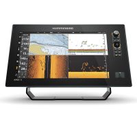

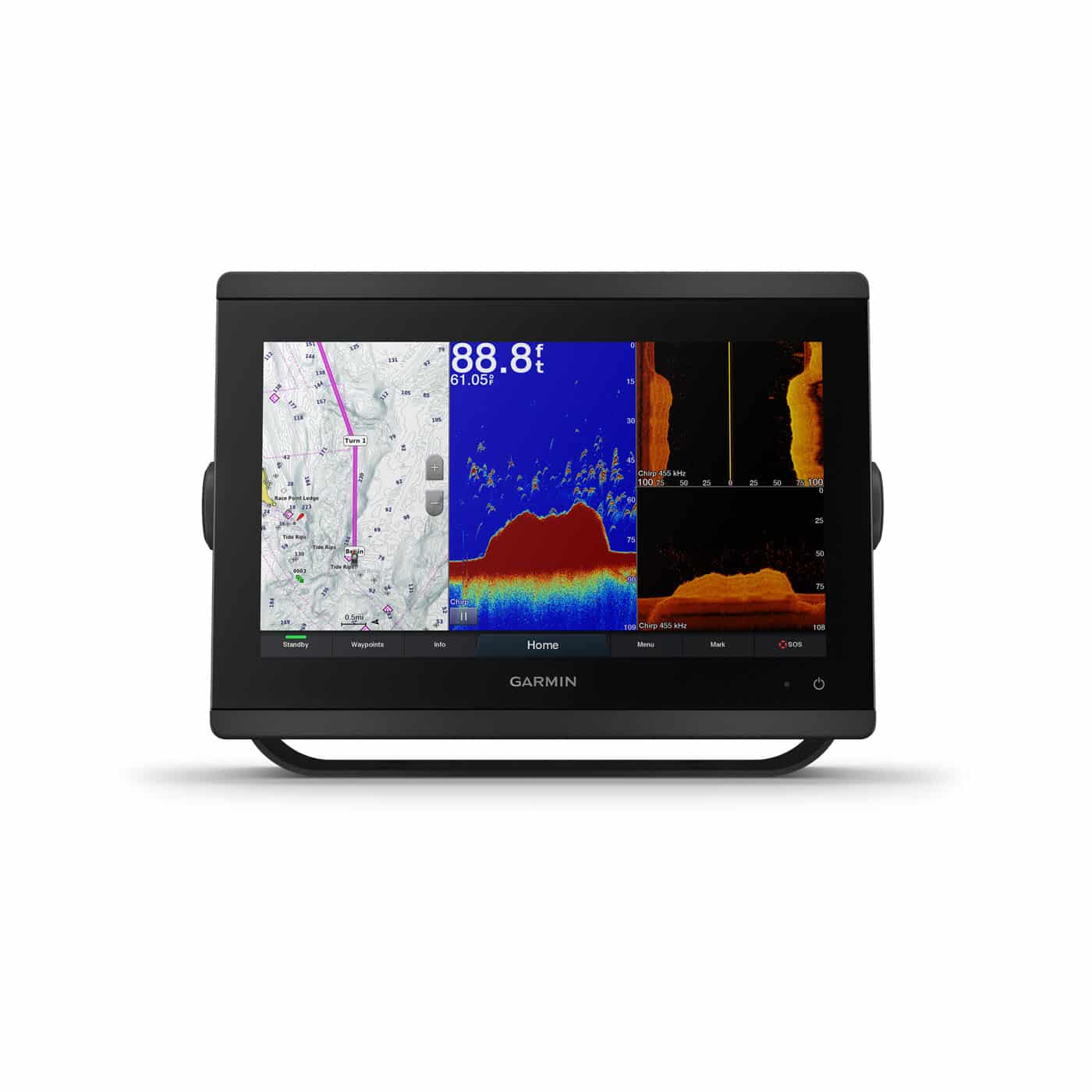
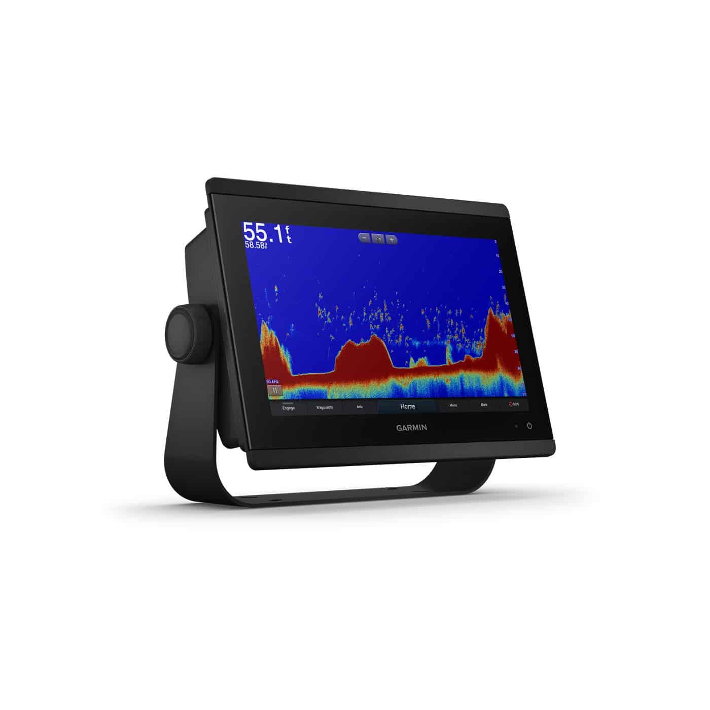
Description
Serious sport fishermen, cruisers, sailors and sail racers demand serious equipment. The easy-to-use, easy-to-install GPSMAP 8612xsv chartplotter/sonar combo delivers MFD performance in a combo-size package. It features a 12” full HD IPS touchscreen display for wider viewing angles, superior clarity and sunlight readability, even with polarized sunglasses. Multiple displays can be flat mounted edge-to-edge to create a sleek glass helm look or can be mounted flush.
Complete Sonar Support
The GPSMAP 8612xsv chartplotter/sonar combo offers built-in support for our industry-leading sonar, including dual-channel 1 kW traditional CHIRP, CHIRP ClearVü and CHIRP SideVü scanning sonars plus built-in support for Ultra High-Definition scanning sonar (no black box required). It also supports the entire Panoptix all-seeing sonar line (transducers sold separately).
The Best of Garmin with the Best of Navionics
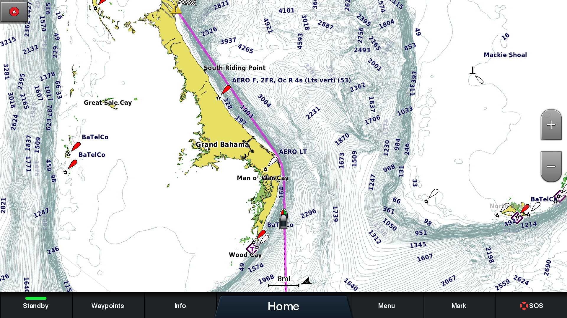
Experience unparalleled coverage and detail with built-in Garmin Navionics+ integrated coastal and inland mapping that includes Auto Guidance+ technology and a 1-year subscription for downloadable daily updates and more on select chartplotters
Build Your Marine System
NMEA 2000 networking and the Garmin Marine Network allow you to easily build your full marine electronics suite — from radar and autopilots to cameras, instruments and forward-looking sonar — controlled from your chartplotter and shared across multiple screens. In addition, our exclusive OneHelm system coordinates many third-party manufactured onboard marine products to bring full control of systems — such as digital switching, lighting, stabilization and more — conveniently to your chartplotter screen.
Full Connectivity
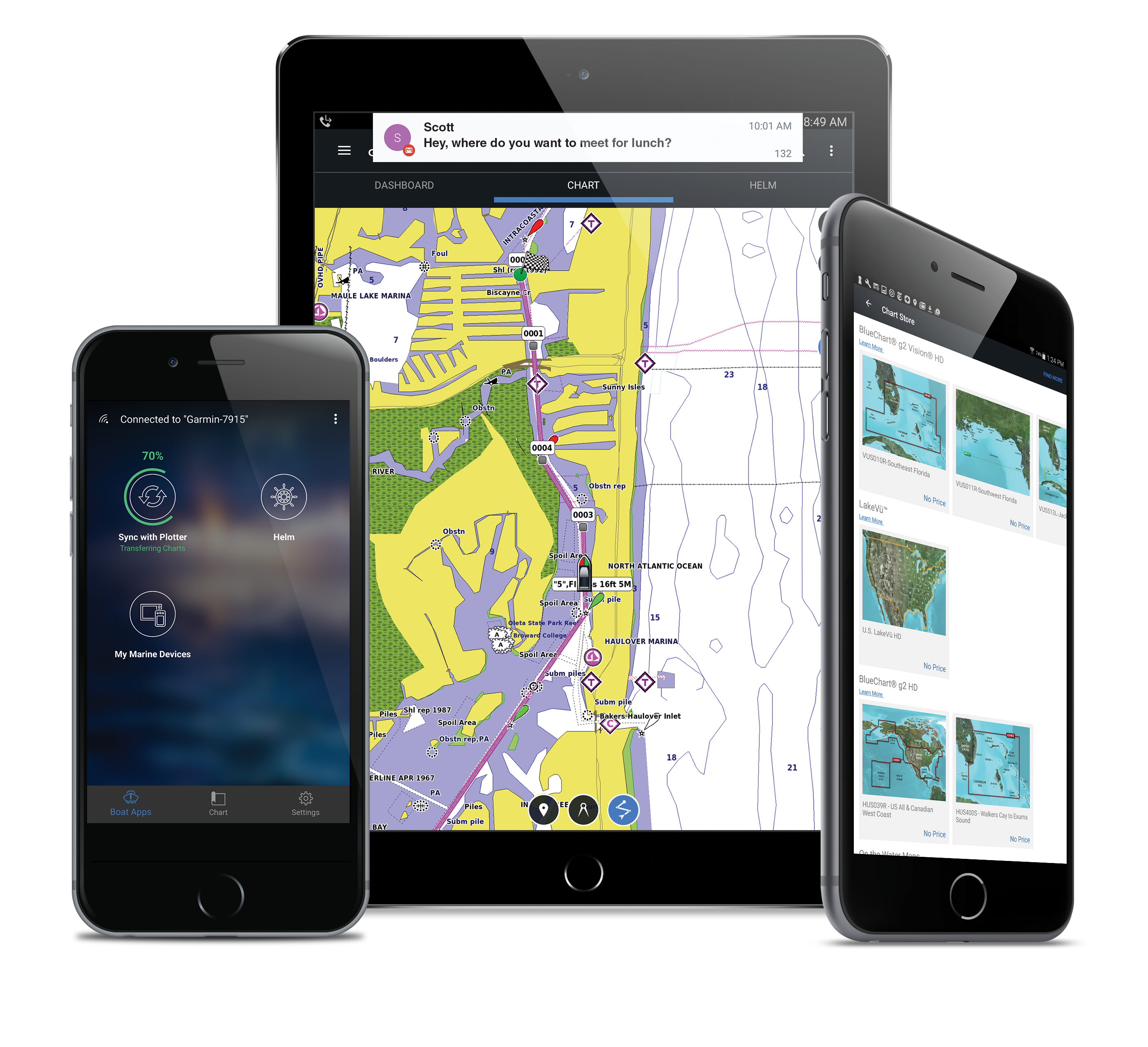
The GPSMAP 8612xsv chartplotter has a premium-performance processor that enables fast map drawing, superior networking, video distribution and more. Built-in Wi-Fi technology lets you pair with the free ActiveCaptain app for access to OneChart, smart notifications, Garmin Quickdraw community data and more. You can also control video streaming from our GC 100 wireless camera and VIRB® action cameras. In addition, built-in ANT wireless technology connects you directly to our quatix marine watch, gWind Wireless 2 transducer and wireless remote controls.
SmartMode Station Controls
Networked sonar, radar, cameras, media and digital switching can be independent or incorporated into SmartMode station controls. With SmartMode, everything is designed to give you quick, one-touch access to the information you need to ease high-stress situations such as docking.
Special Sailing Features
The Garmin SailAssist feature provides data, displays and prerace guidance to help you gain a competitive edge. Other sailing features include laylines, enhanced wind rose, heading and course-over-ground lines, true wind data fields and tide/current/time slider. Gauge displays provide need-to-know information at a glance, including true and apparent wind angle, set and drift, true or apparent wind speed, horizontal or vertical graphs and a data bar with customizable fields.
The Ultimate Connected Boating App
Download the ActiveCaptain app to your smartphone or tablet to manage your marine experience from anywhere — from trip planning and prefishing to updating software and purchasing maps.
Physical & Performance
|
Dimensions |
11.9″ x 8.5″ x 3″ (30.3 cm x 21.6 cm x 7.6 cm) |
|
Display resolution |
1920 x 1080 pixels |
|
Display Size |
10.1″ x 5.7″; 11.6″ diagonal, 25.7 cm x 14.5 cm; 29.5 cm diagonal |
|
Receiver |
10 Hz GPS/GLONASS/Galileo |
|
Water rating |
IPX7 |
|
Weight |
6.0 lbs. (2.7 kg) |
|
Mounting options |
Bail, flat or flush (Garmin do not offer any hardware or accessories for a flat-mount installation. Professional tools and knowledge is required.) |
|
Display type |
touchscreen IPS display (anti-glare finish) |
|
Antenna |
Internal or external over NMEA 2000 |
Maps & Navigation
|
Preloaded maps |
Navionics + |
|
Accepts data cards |
2 microSD cards (on back) |
|
Routes |
100 (250 waypoints each) |
|
Track log |
50,000 points; 50 saved tracks |
Features
|
ClearVü |
yes |
|
Waypoints |
5,000 |
|
Transmit power |
1 kW traditional; 1 kW CHIRP |
|
NMEA 0183 compatible |
Yes |
|
Dual-beam (77/200 kHz) sonar capable |
Yes |
|
Supports DSC (displays position data from DSC-capable VHF radio) |
Yes |
|
Additional |
|
|
NMEA 2000 compatible |
Yes |
|
ActiveCaptain compatible |
yes |
|
Sonar recording |
Yes |
|
Garmin Marine Network ports |
2 |
|
Garmin Sonar compatible |
Yes |
|
GSD Black Box sonar support |
Yes |
|
Sonar history rewind |
Yes |
|
Garmin SmartMode compatible (customizable monitor presets) |
Yes |
|
Maximum depth |
5,000 ft at 1 kW (depth capacity is dependent on water bottom type and other water conditions) |
|
Dual-frequency (50/200 kHz) sonar capable |
Yes |
|
SiriusXM Weather & Radio compatible |
Yes |
|
Wireless connectivity |
yes |
|
Water temperature log and graph |
Yes |
|
GCV Black Box sonar support |
Yes |
|
Wireless mouse compatible |
No |
|
NMEA 0183 input ports |
1 differential |
|
J1939 Compatible |
Yes |
|
Supports AIS (tracks target ships position) |
Yes |
|
Polarized support |
Yes |
|
Garmin Meteor™ Audio System compatible |
No |
|
Frequencies supported |
Traditional: 50/200, 77/200, 83/200 Single Channel CHIRP: 40-250 Dual Channel CHIRP: 40-250 SideVü/ClearVü: CHIRP 260/455/800 Ultra High-Definition ClearVü: 0.8 MHz (800 kHz), CHIRP range: 760-880 kHz Ultra High-Definition SideVü: 1.2 MHz (1,200 kHz), CHIRP range: 1,020-1,230 kHz(dependent on transducer) |
|
Wireless remote compatible |
Yes |
|
Supports FUSION-Link compatible radios |
Yes |
|
Transducer pin numbers |
1 – LVS sonar, 1 – 12 pin scanning sonar, 1- 8 pin sonar |
|
Bottom lock (shows return from the bottom up) |
Yes |
|
NMEA 0183 output ports |
1 differential |
|
Tide tables |
Yes |
|
Power consumption |
1.3A Typical |
|
Garmin Radar compatible |
Yes |