
Description
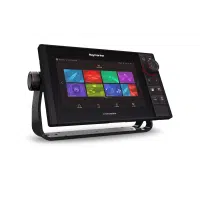
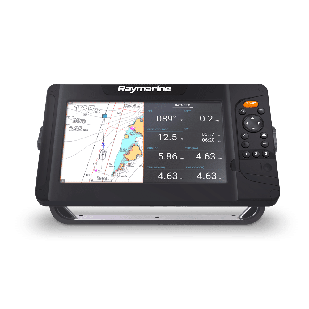
Raymarine Element 9 S – 9″ Chart Plotter with Wi-Fi & GPS, Navionics+ US and Canada Chart & No Transducer.
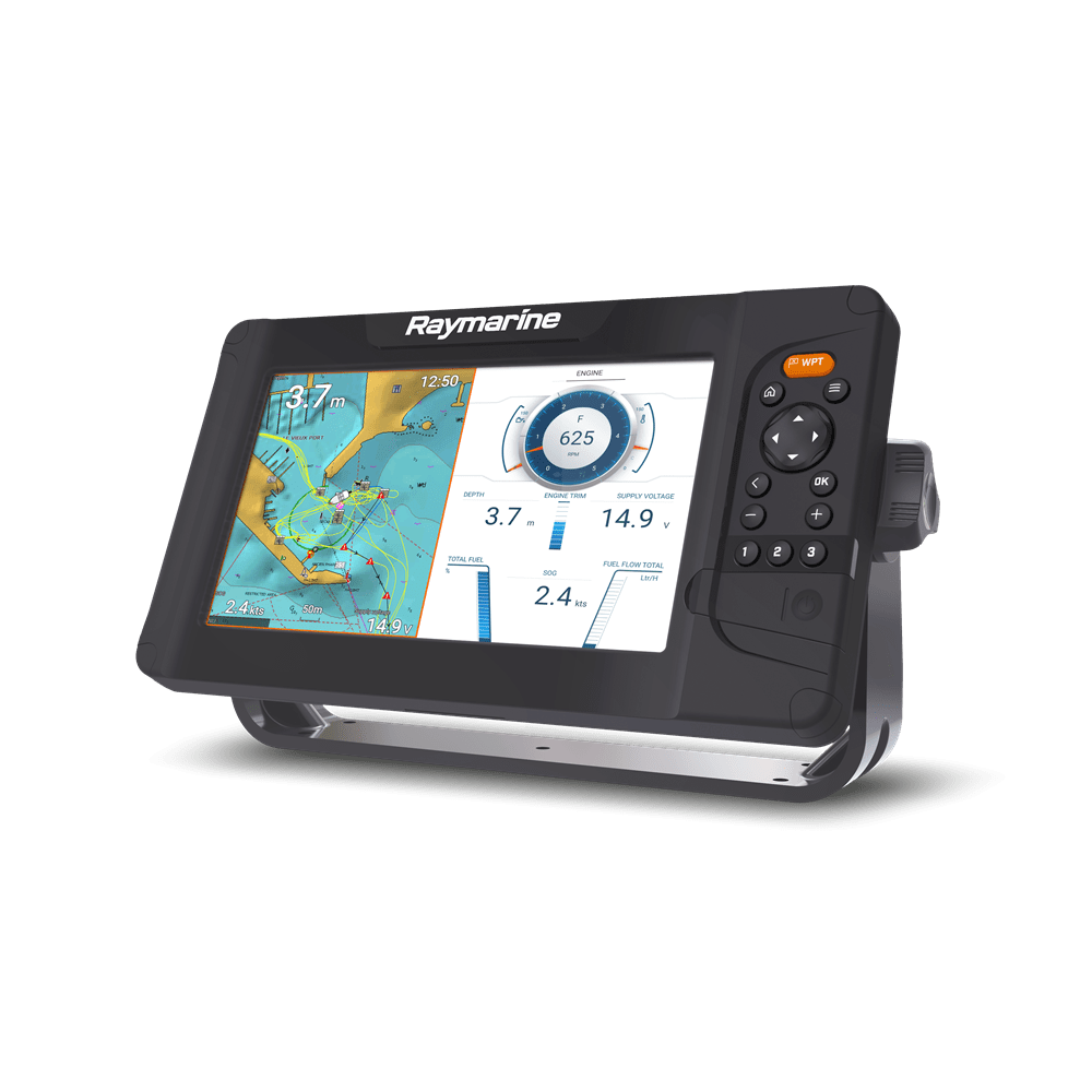
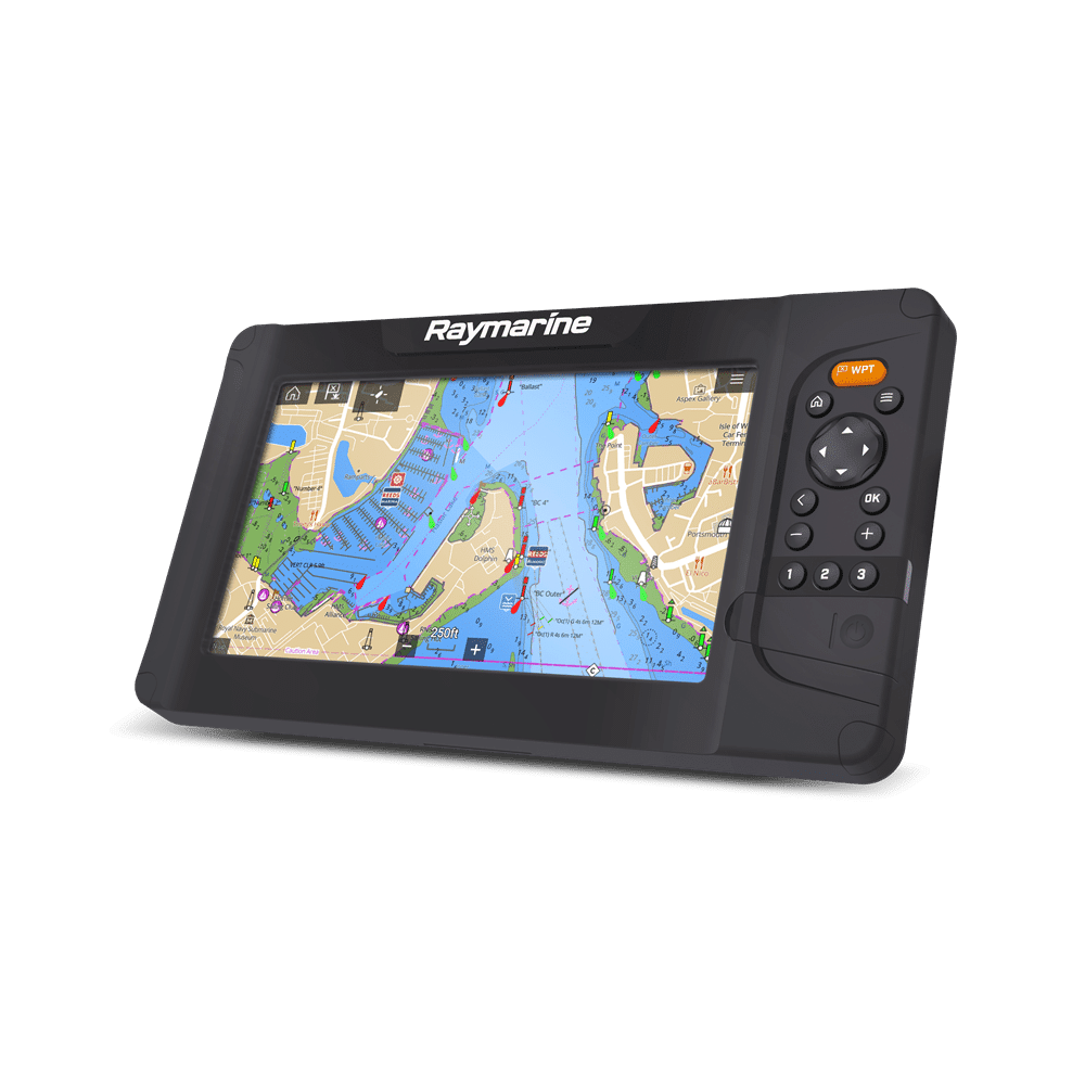
The Element S series of chartplotters gives you the freedom to enjoy the open waters: Select your destination and let Element’s fast and accurate 10Hertz GPS/GNSS lead the way. Engineered for simplicity and affordable performance, Element S will quickly become your trusted cruising companion. A quad-core processor offers responsive performance and Element’s all-weather, sunlight viewable displays deliver nautical charts and navigation data in beautiful color.
Features
- Support For Raymarine LightHouse Charts, Navionics, And C-MAP
- Safely Navigate Busy Waterways With An Optional Quantum Wireless Radar
- Built-In High CHIRP Sonar For Depth And Bottom Contour Imaging
- Map Uncharted Areas With Raymarine RealBathy Personal Sonar Mapping
- Connect With NMEA2000 Compatible AIS, Autopilot, Sailing Instruments, Engines, Tanks, And VHF
- From Sailing To Power Cruising To Fishing, The LightHouse Sport OS Is Easy To Customize To Your Type Of Boating
- An Oversized Waypoint Key For Quick And Easy Marking Of Your Favorite Locations
- Three User-Programmable Quick Keys Provide Access Your Favorite Pages With One Button Push
- Powerful Quad-Core Processor Delivers Fast Chart Redraw And Responsive Performance
- Limited 3 Year Warranty
| Dimensions | |
| Trunnion Mount | Height: 171 mm (6.73 in), Width: 308.4mm (12.14in), Depth: 149.40 mm (5.88 in) |
| Surface Mount | Height: 161.00 mm (6.34 in), Width: 286.50 mm (11.28 in), Depth: 149.40 mm (5.88 in) |
| Weight | 1.3 Kg (2.86lbs) |
| Display | |
| Screen (Diagonal) | 9” |
| Resolution | WVGA 800 x 480 |
| Ratio | 5:3 |
|
Viewing Angle (T/ B/ L/ R) |
50° / 70° / 70° / 70° |
| Type | TN (Twisted Nematic) |
| Color Depth | 24-bit |
| Maximum Illumination | 1500 nits / 1500 cd/m2 |
| Power | |
| Operating Voltage Range | 8 V dc to 16 V dc (protected up to 32 V dc) |
| Power consumption (Approximate @ 12 V dc) | Power consumption (Approximate @ 12 V dc) |
| Nominal supply voltage | 12 V DC |
| Fuse Requirement | Inline fuse = 5 A, Thermal breaker = 3 A |
| LEN (NMEA 2000 Load Equivalency Number) | 1 (Based on 9 V dc nominal voltage) |
| Data Connections | |
| SeaTalkng / NMEA 2000 | 1 x DeviceNet female connector built into power cable |
| 2.4 GHz Wi-Fi | 1 x 802.11/b/g/n |
| Transducer | 1 x 15-pin connector |
| Storage | |
| External | 1 x MicroSDXC card slot |
| Environmental | |
| Operating temperature range | -25°C (-13°F) to +55°C (+131°F) |
| Storage temperature range | -30°C (-22°F) to +70°C (+158°F) |
| Humidity | up to 93% @ 40°C (+104°F) |
| Waterproof rating | IPx6, IPx7 |
| GPS Receiver | Position Accuracy |
| Geodetic Datum | WGS-84 (alternatives can be selected on the MFD) |
| Channels | Multiple – ability to simultaneously track up to 28 satellites |
| Antenna | Internal – Ceramic chip mounted near top of unit |
| GNSS compatibility | GPS, GLONASS, Beidou |
| SBAS compatibility | EGNOS, GAGAN, MSAS, QZSS, WAAS |
| Signal Acquisition | Automatic |
| Almanac Update | Automatic |
| Receiver IC Sensitivity | 165 dBm (Tracking), 160 dBm (Acquisition), 148 dBm (Cold start) |
| Operating frequency | 1574 MHz to 1605 MHz |
| Cold Start | 2 Minutes |