
Description
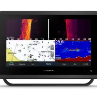
With its sleek design, powerful processing and upgraded IPS display, this advanced 12” chartplotter/sonar combo integrates seamlessly into your Garmin marine system.
FAST, SHARP, SMART
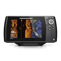
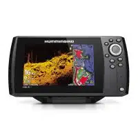
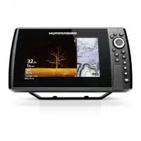
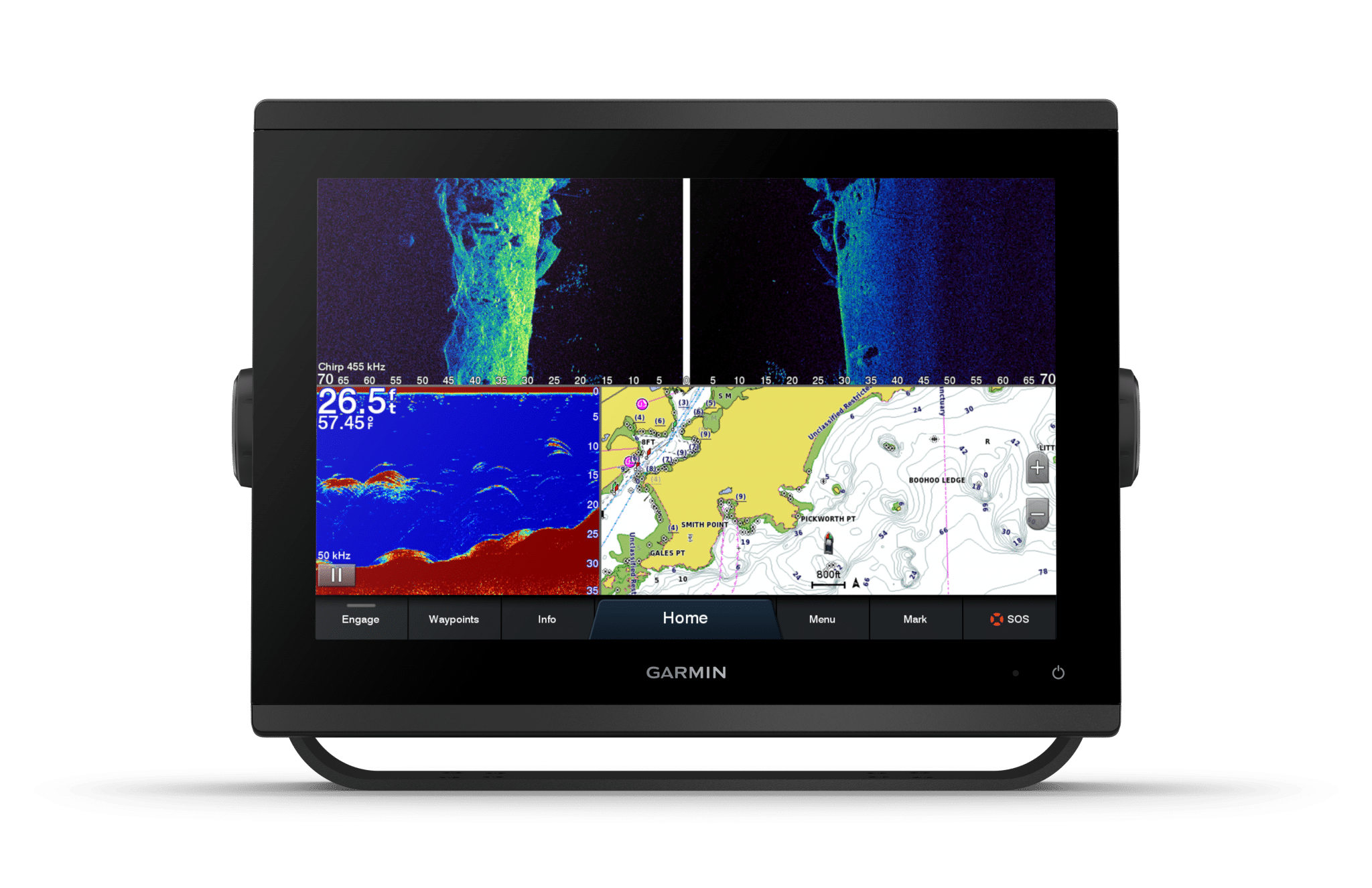
With its ultrasleek design, vivid sonar color palette and high-resolution 12” in-plane switching display, this large format chartplotter/sonar combo offers improved sunlight readability and wide-angle visibility.
PRELOADED MAPPING
Experience unparalleled coverage and detail with preloaded BlueChart g3 coastal charts and LakeVü g3 inland maps featuring integrated Garmin and Navionics® content and Auto Guidance3 technology
OPTIONAL BLUECHART G3 VISION CHARTS
Upgrade to Garmin’s reliable premium charts, which add even more unparalleled features, such as high-resolution relief shading, to help you on each trip.
GARMIN MARINE NETWORK
If you have multiple compatible Garmin devices on your boat, you can share information — such as maps, user data, radar and IP camera video — among them.
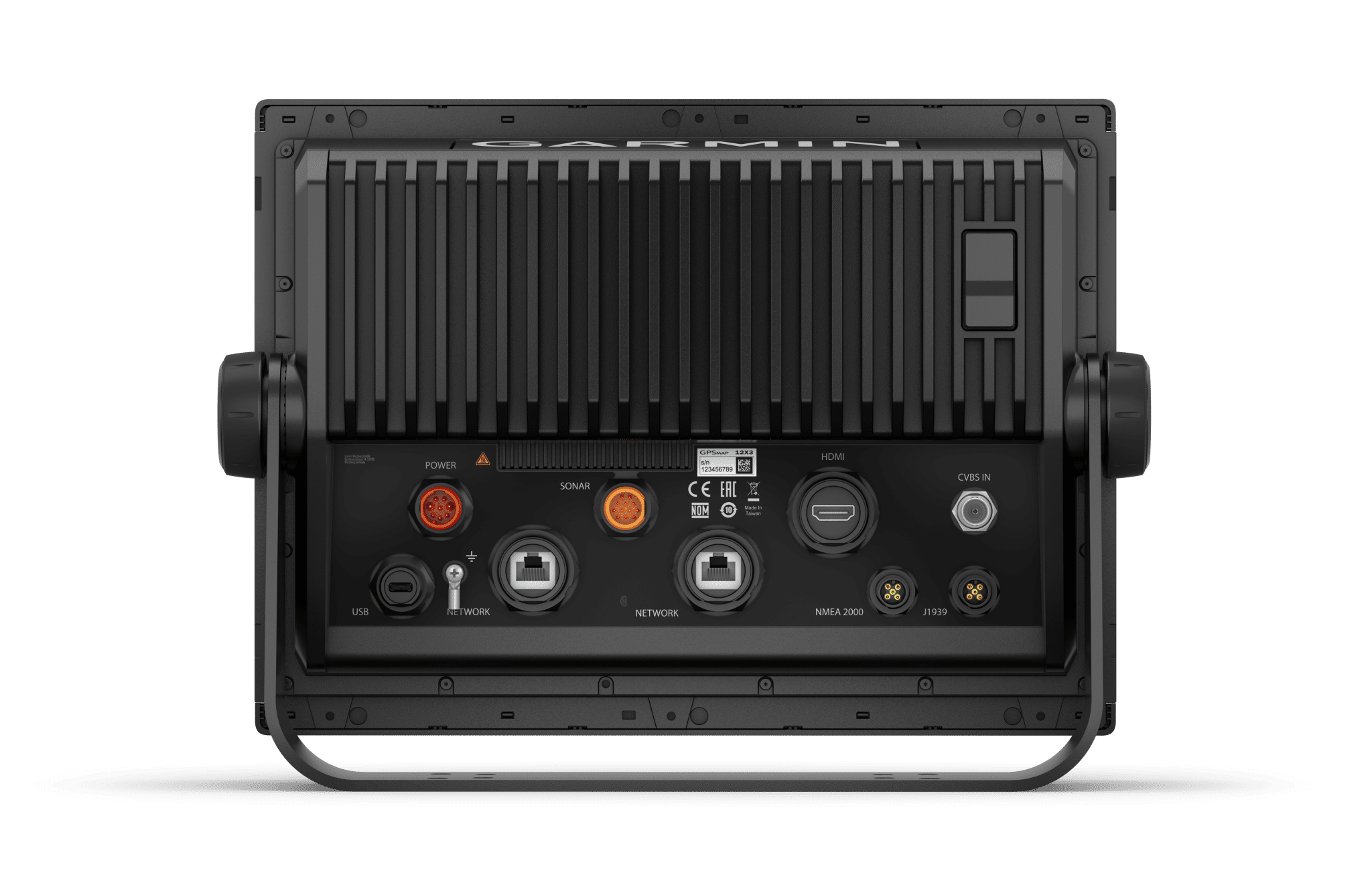
NMEA 2000 AND NMEA 0183 NETWORKS
Connect to compatible autopilots, digital switching, weather, Fusion-Link™ audio system, media, VHF, AIS and more from one screen.
ACTIVECAPTAIN APP
Built-in Wi-Fi connectivity pairs with the free all-in-one mobile app for access to the OneChart feature, smart notifications, software updates, Garmin Helm digital switching, Garmin Quickdraw Community data and more.
INTEGRATED ANT TECHNOLOGY
Connect with some of your favorite devices, such as quatix marine watches, gWind Wireless 2 transducers, GNX Wind marine instruments and wireless remote controls.
J1939 CONNECTIVITY
Now you can connect your chartplotter to different kinds of engines, including select Yamaha engines.
ONEHELM FEATURE
This exclusive feature brings together all the operations and capabilities of select third-party devices, such as EmpirBus digital switching, on one screen.
Physical & Performance
| Display size |
10.3″ x 6.4″; 12.1″ diagonal (26.2 x 16.3 cm; 30.7 cm diagonal) |
| Display resolution | 1280 x 800 pixels |
| Physical dimensions | 12.1” x 8.9” x 3.2” (30.8 x 22.8 x 8.2 cm) |
| Receiver | 10 Hz high-sensitivity |
| Water rating | IPX7 |
| Weight | 6.6 lbs. (3.0 kg) |
| Mounting options | Bail or flush |
| Display type | WXGA display |
| Antenna | Internal or external over NMEA 2000 |
Maps & Navigation
| Preloaded maps | BlueChart® g3 (coastal maps) and LakeVü g3 (inland maps) |
| Accepts data cards | 2 microSD™ cards (back of unit) |
| Routes | 100 |
| Track log | 50,000 points; 50 saved tracks |
Features
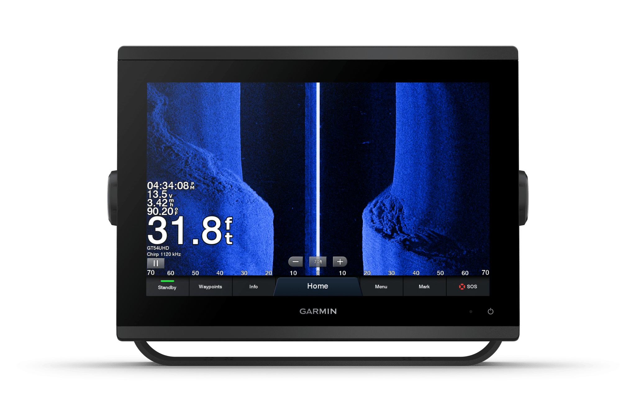
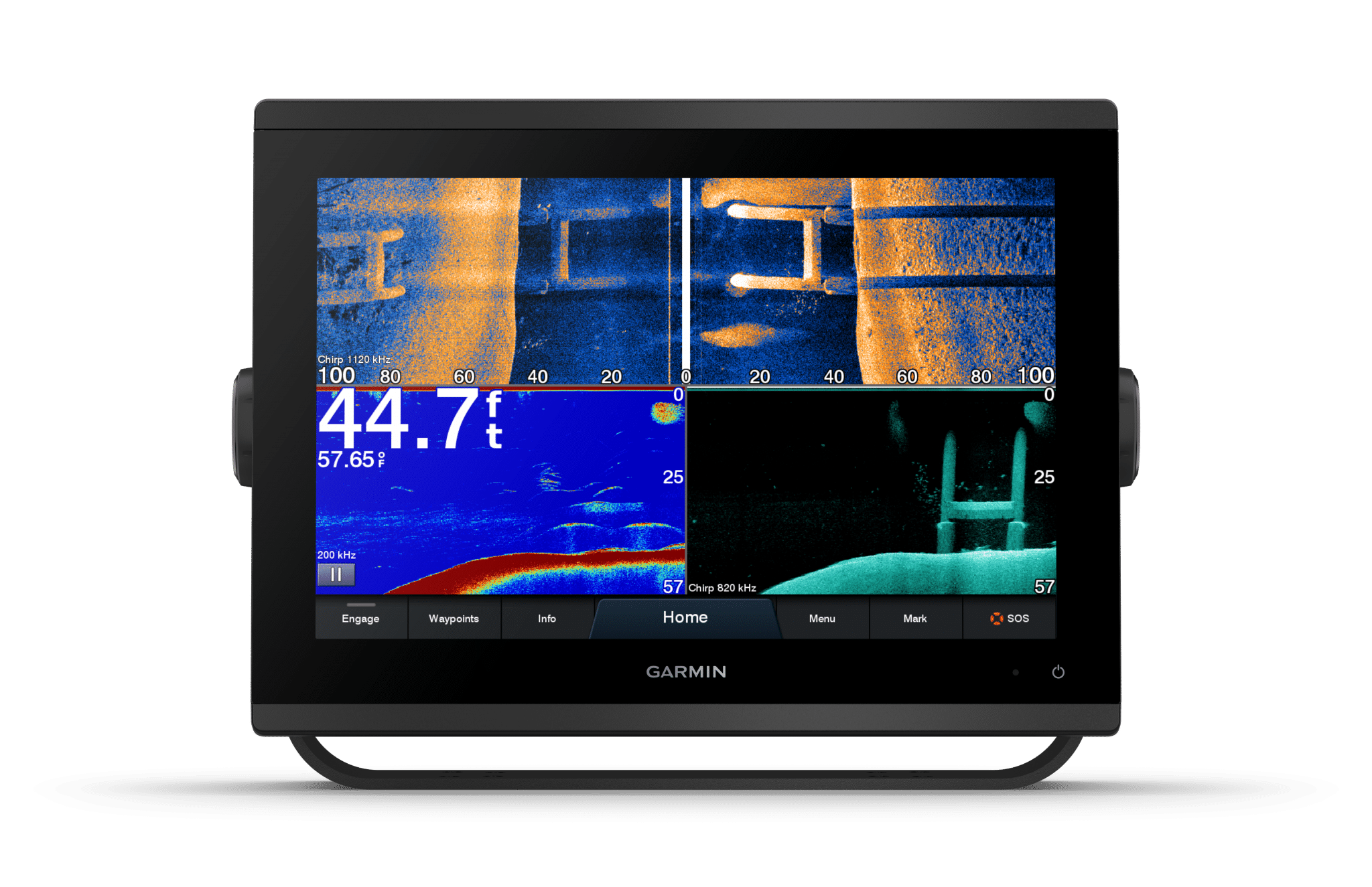
| ClearVü | Yes with CHIRP (built-in) |
| Waypoints | 5,000 |
| Transmit power | 1 kW traditional; 1 kW CHIRP |
| NMEA 0183 compatible | Yes |
| Dual-beam (77/200 kHz) sonar capable | Yes |
| Supports DSC (displays position data from DSC-capable VHF radio) | Yes |
| Additional |
|
| NMEA 2000® compatible | Yes |
| ActiveCaptain compatible | Yes |
| Sonar recording | Yes |
| Garmin Marine Network™ ports | 2 |
| Garmin Sonar compatible | Yes (built-in) |
| GSD™ Black Box sonar support | Yes |
| Sonar history rewind | Yes |
| Garmin SmartMode compatible (customizable monitor presets) | Yes |
| Dual-frequency (50/200 kHz) sonar capable | Yes |
| Maximum depth | 5,000 ft at 1kW (depth capacity is dependent on water bottom type and other water conditions) |
| SiriusXM™ Weather & Radio compatible | Yes |
| Wireless connectivity | Yes |
| Water temperature log and graph | Yes |
| GCV™ Black Box sonar support | Yes |
| Wireless mouse compatible | No |
| NMEA 0183 input ports | 1 |
| J1939 Compatible | Yes |
| Supports AIS (tracks target ships position) | Yes |
| Polarized support | Yes |
| Frequencies supported | ClearVü/SideVü (260/455/800/1000/1200 kHz) |
| Wireless remote compatible | Yes |
| Supports FUSION-Link™ compatible radios | Yes |
| Transducer pin numbers | 12-pin (orange) |
| Bottom lock (shows return from the bottom up) | Yes |
| NMEA 0183 output ports | 1 |
| Tide tables | Yes |
| Power consumption |
Max power usage at 10 Vdc: 26.5 W Typical current draw at 12 Vdc: 1.7 A Max current draw at 12 Vdc: 2.2 A |
| Garmin Radar compatible | Yes |