
Description
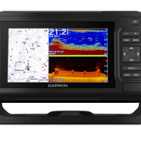
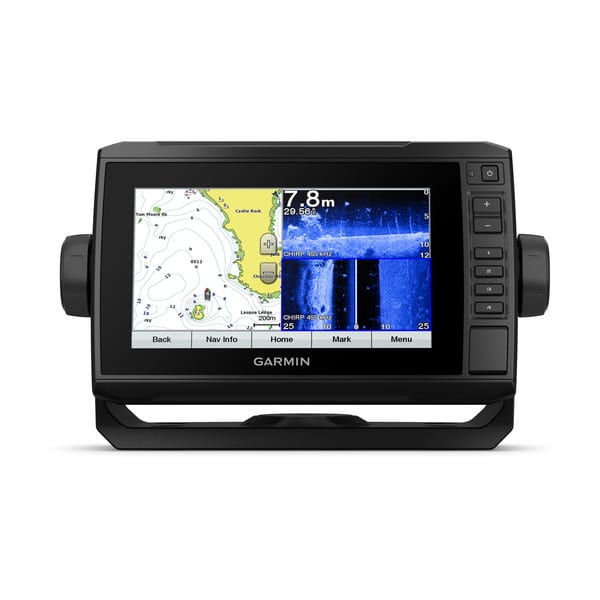
- Bright, sunlight-readable 9” keyed-assist touchscreen combo
- Includes GT51 transducer for Garmin high wide CHIRP traditional sonar plus CHIRP ClearVü and CHIRP SideVü scanning sonars; compatible with Panoptix™ all-seeing sonar (sold separately)
- Preloaded BlueChart® g3 charts for the Canadian coast plus integrated Navionics® data
- Built-in Quickdraw Contours mapping software instantly creates personalized fishing maps on-screen with 1’ contours as you fish
- Built-in Wi-Fi® technology pairs with the free ActiveCaptain® app for access to OneChart™, smart notifications¹, Garmin Quickdraw™ Community data and more

Bright, sunlight-readable 9” combo offers the convenience of a keyed-assist touchscreen. It comes with a GT51 transducer that encompasses Garmin high wide CHIRP traditional sonar plus CHIRP ClearVü and CHIRP SideVü scanning sonars, and it’s also compatible with Panoptix all-seeing sonar. It comes preloaded with BlueChart g3charts for the Canadian coast plus integrated Navionics data. Plus, Quickdraw Contours mapping software lets you instantly create personalized fishing maps on-screen with 1’ contours as you fish. It also has built-in Wi-Fi technology to pair with the free ActiveCaptain app for access to OneChart, which allows you to purchase and download new charts. ActiveCaptain also gives you access to smart notifications¹, the ActiveCaptain Community for marina and other points of interest details, Quickdraw Community data and more. A quick-release bail mount makes it easy to remove and take with you. Transom and trolling motor mounts are included.
The Garmin CHIRP Difference
The built-in sonar capabilities of ECHOMAP Plus 97sv include our CHIRP traditional sonar, one of the most sophisticated sonar technologies available for the fishing and boating public. CHIRP traditional sonar provides amazingly clear target separation and definition because it puts even more energy onto the target than traditional sonar. It also provides traditional sonar support for Minn Kota® and MotorGuide®trolling motors with integrated transducers.
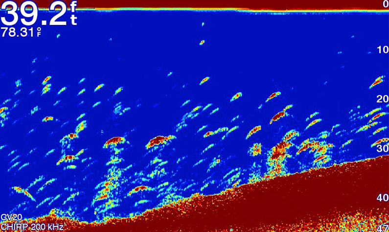
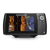
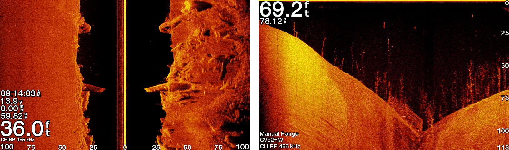
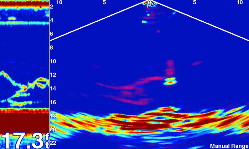
Clear Scanning Sonar Images
Garmin CHIRP ClearVü™ scanning sonar gives you a nearly photographic image of what’s below your boat. Garmin CHIRP SideVü™ sonar shows you incredible detail of what lies off to the sides of your boat. You clearly see structure, submerged objects and fish. Garmin CHIRP traditional sonar and CHIRP ClearVü and CHIRP SideVü scanning sonars are combined into 1 transducer.
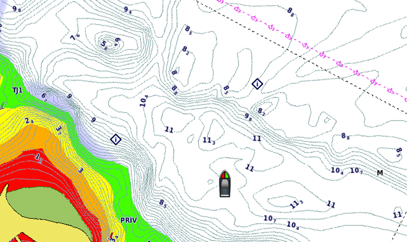
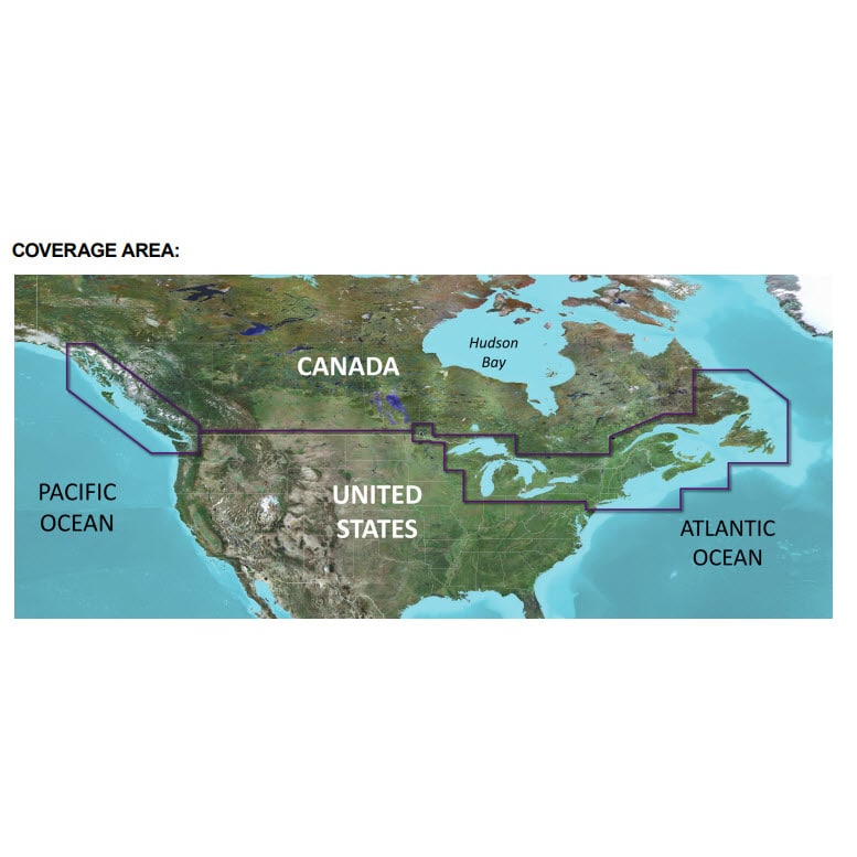
Preloaded Canada BlueChart g3 Charts
These highly detailed Canadian coastal charts cover the upper east coast of North America, U.S. and Canadian Great Lakes and upper western coast of North America from Aberdeen, Washington, to Glacier Bay, Alaska. Canada BlueChart g3 data is derived from official charts and private sources to provide navigational aids, spot soundings, depth contour, tides and currents and more.
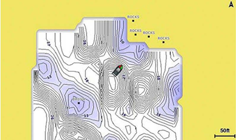
Quickdraw Contours to Create Your Own Maps
Instantly create personalized fishing maps on-screen with 1’ contours while you fish. Tailor them to fit your needs. These are your maps — you own them. Keep the data to yourself, or share it with the Quickdraw Community on Garmin Connect™.
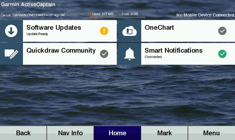
Get Connected with the ActiveCaptain App
Our free all-in-one ActiveCaptain app allows you to manage your marine experience from nearly anywhere. It creates a simple yet powerful connection between your compatible mobile device and your chartplotter, charts, maps and the community. Use the combo’s built-in Wi-Fi to pair with the free ActiveCaptain app for access to OneChart, which allows you to update or purchase and download new charts. ActiveCaptain also gives you access to smart notifications¹, the ActiveCaptain Community for marina and other points of interest details, Quickdraw Community data and more.
Garmin SailAssist™ Features
SailAssist features include laylines, enhanced wind rose and heading and course-over-ground lines. At a glance, you can see true and apparent wind angle and speed as well as set and drift. To help you gain a wind-maximizing competitive edge, your chartplotter shows a pre-race guidance page that shows your virtual starting line along with data fields showing laylines, time to burn before the start and a race timer.
Upgrade to Our Best Charts on the Water
Step up to BlueChart® g3 Vision coastal charts with integrated Navionics data, Auto Guidance² technology and other great features. A single microSD™ card slot provides expandable memory for accessory chart purchases. Or purchase maps with OneChart through the ActiveCaptain app, and automatically sync with your compatible chartplotter, eliminating the need for an SD™ card.
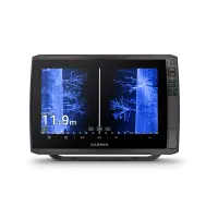
See Fish Swimming in Real Time
Add optional Panoptix all-seeing sonar, and see all around your boat and below it — in real time, even while your boat is stationary. See your lure as it sinks, relative to structure in the water. Watch the movement of fish — and their reactions to your bait — up to 100’ away or below the boat.
NMEA 2000® Network Support
ECHOMAP Plus 97sv provides NMEA 2000 support for engine data, sensors, FUSION-LINK™ audio system, autopilots and more.
Take Your ECHOMAP Plus with You
When you’re off the water, it’s easy to keep your ECHOMAP Plus combo safe and secure. You don’t have to mess with plugging and unplugging wires from the unit, because the cords plug directly into the mount. This allows you to quickly install and remove your ECHOMAP Plus from power and the mount.
¹When paired with a compatible mobile device
²Auto Guidance is for planning purposes only and does not replace safe navigation operations
| General | |
| Physical dimensions | 11.4″ x 6.5″ x 2.4″ (28.2 x 16.4 x 6.0 cm) |
| Display size | 7.8″ x 4.8″; 9″ diagonal (19.9 x 11.3 cm; 22.9 cm diagonal) |
| Display resolution | 400 x 800 pixels |
| Display type | WVGA display |
| Weight | 2.3 lbs (1.0 kg) |
| Water rating | IPX7 |
| Power consumption | 18W |
| Antenna | Internal or external over NMEA 2000 |
| Mounting options | Bail or flush |
| Receiver | 5 Hz |
| Garmin Marine Network™ ports | 1 Panoptix™ port |
| Maps & Memory | |
| Preloaded maps | BlueChart® g3 (coastal maps) |
| Accepts data cards | 1 microSD™ card; 32 GB maximum card size |
| Waypoints | 5,000 |
| Routes | 100 |
| Track log | 50,000 points; 50 saved tracks |
| Outdoor Recreation Features | |
| Tide tables | Yes |
| Chartplotter Features | |
| Garmin Sonar compatible | Yes |
| Supports AIS (tracks target ships position) | Yes |
| Supports DSC (displays position data from DSC-capable VHF radio) | Yes |
| Supports FUSION-Link™ compatible radios | Yes |
| Sonar Features & Specifications | |
| Dual-frequency (50/200 kHz) sonar capable | Yes |
| Dual-beam (77/200 kHz) sonar capable | Yes |
| Transmit power | 500 W (RMS) / 4,000 W (peak to peak) |
| CHIRP sonar technology | Yes (Built-in) |
| ClearVü | Yes with CHIRP (built-in) |
| SideVü | Yes with CHIRP |
| Maximum depth |
2,300 ft @ 77 kHz, freshwater 1,100 ft @ 77 kHz, saltwater (depth capacity is dependent on water bottom type and other water conditions) |
| Bottom lock (shows return from the bottom up) | Yes |
| Water temperature log and graph | Yes |
| Sonar recording | Yes |
| Sonar history rewind | Yes |
| Connections | |
| NMEA 2000® compatible | Yes |
| Transducer pin numbers | 12 |
| NMEA 0183 input ports | 1 |
| NMEA 0183 output ports | 1 |
| Video input ports | None |
| Video output ports | None |
| Wireless connectivity | Yes |